Karst features of Lawn Hill Gorge area

Background

This is the dissected margin of the taleland that forms most of the Barkly Karst Region. The area has incised gorges, extensive grike fields on the plateau remnants, and springs with spring tufa deposits. There are also caves, but these are not yet well explored.
The climate is semi-arid monsoon.

Selected photographs and diagrams

To view full size images, click on the displayed image.
Air photo of Lawn Hill Gorge - about 5 km across.
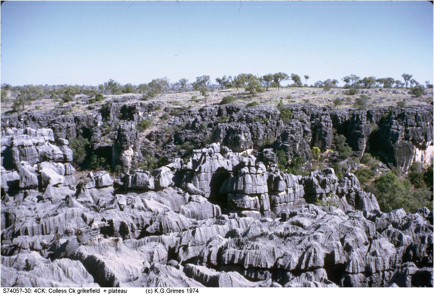
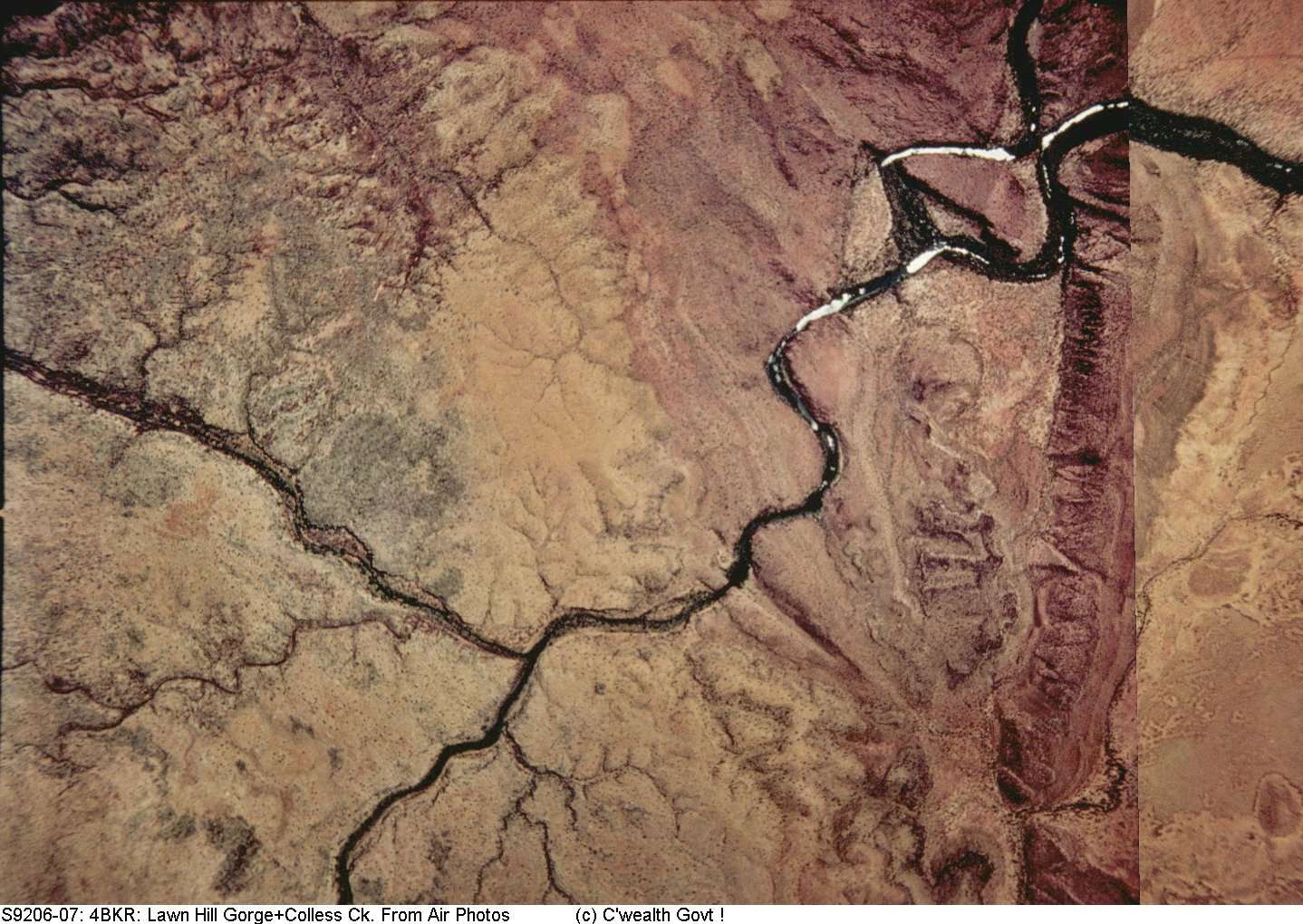
The western half is limestone (pale colour) with grey areas that are grike fields.
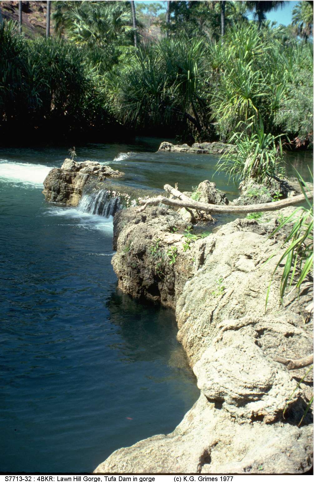
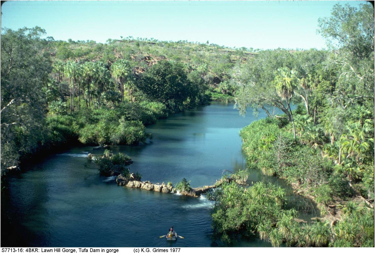
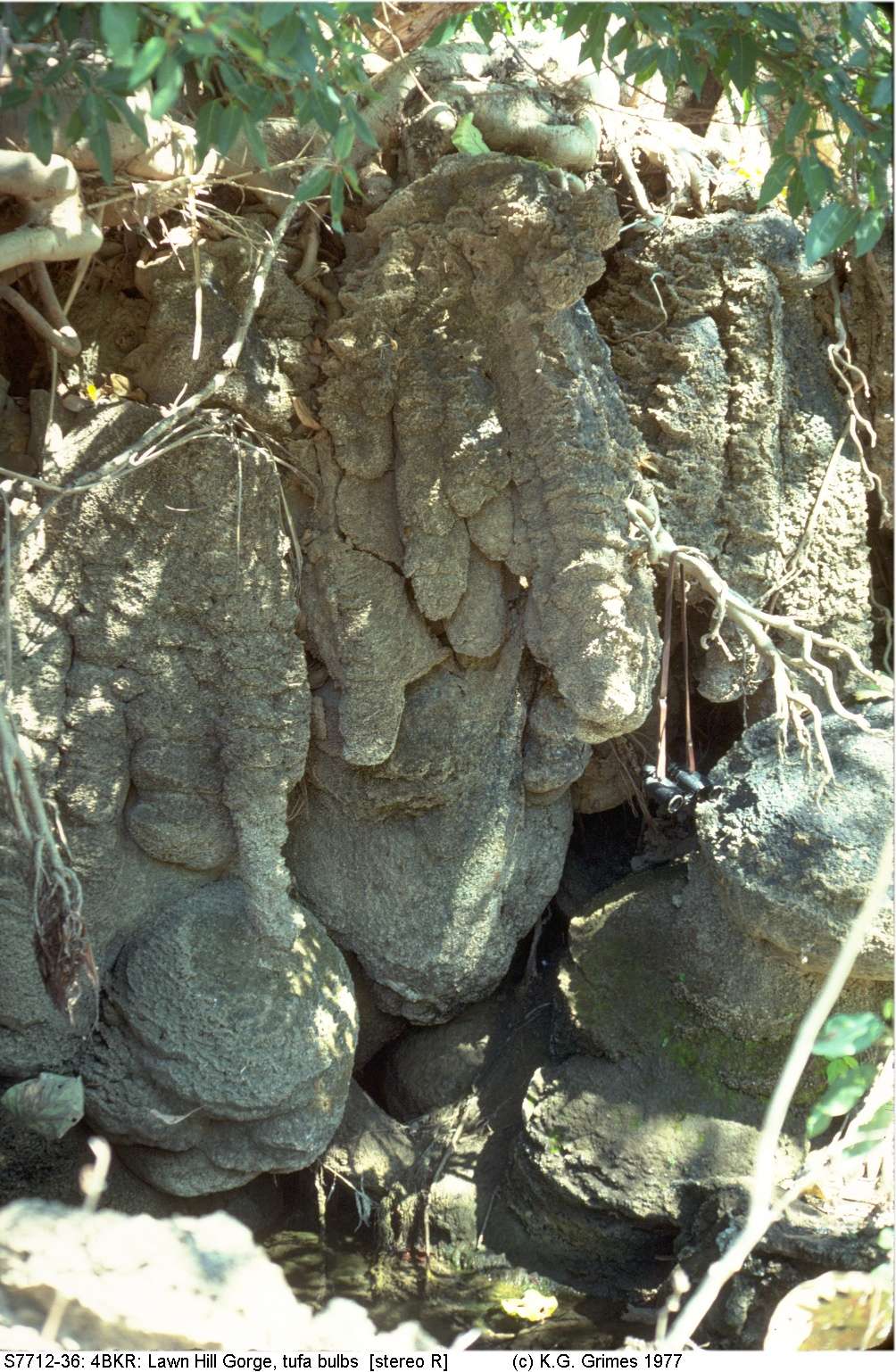
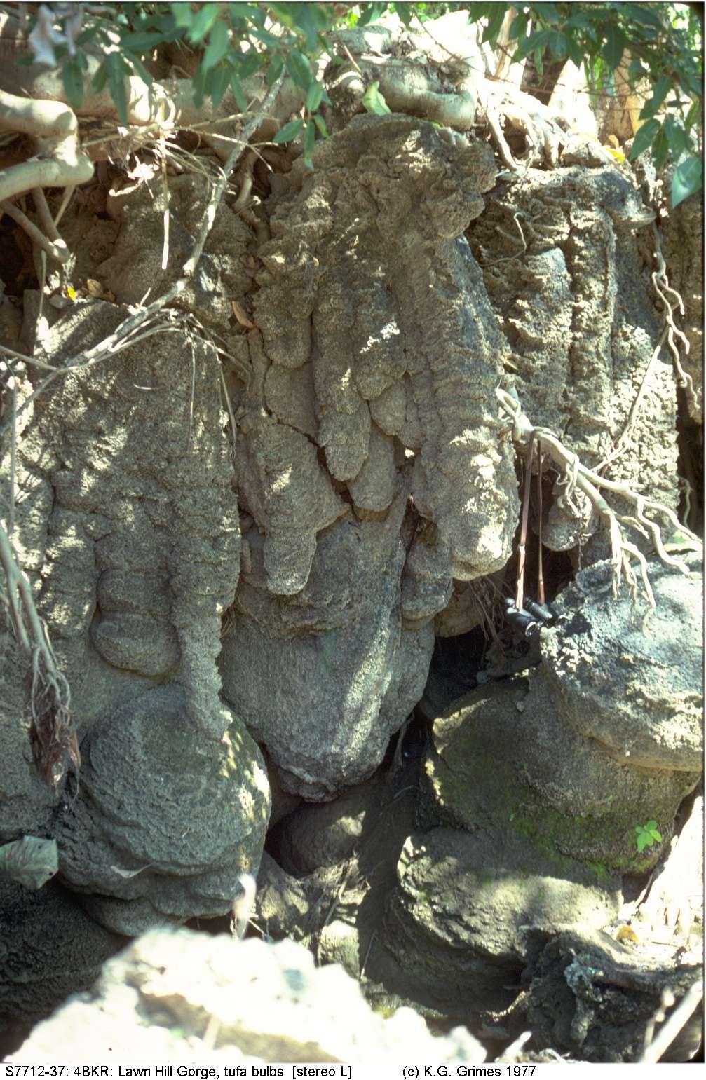
The main part of the gorge (right) is in older, steeply dipping, sandstone but contains tufa dams.
The main stream (Lawn Hill Creek) is spring fed and incised into an old plateau.
The "island" in the NE occurs where the original stream (flowing on what was then a flat floodplain) bifurcated, nearly rejoined, then diverged in two directions. This "superimposed drainage pattern" is now incised into the old plateau as part of the gorge.
Part of the Colless Creek grike field in forground, with the incised gorge of Colless Creek behind it and a remnant of the original plateau surface in the distance.
IMG00254.jpg

Two views of a major tufa dam built across the sandstone part of Lawn Hill Gorge.
IMG00244.jpg and IMG00243.jpg
Stereopair of a tufa wall (view cross-eyed)

Go to Main Index menu