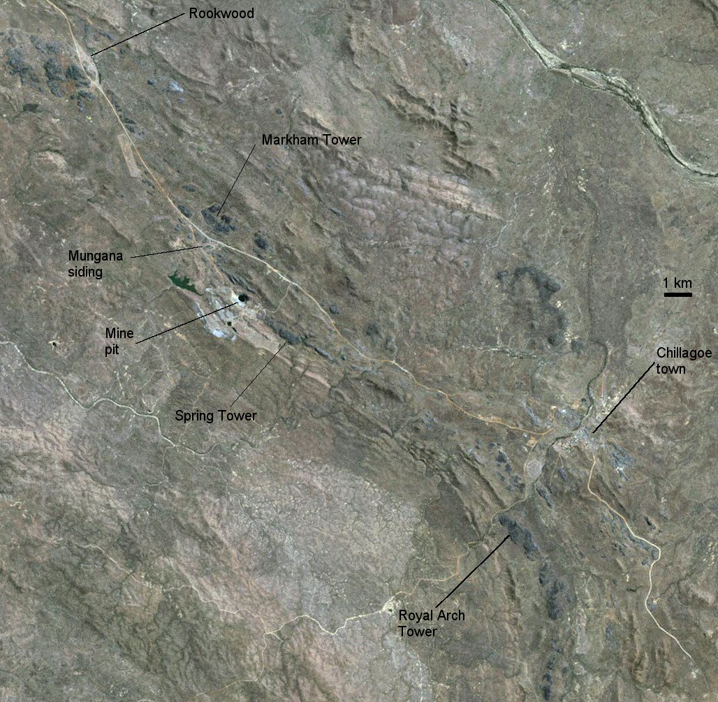
The grey areas are the limestone towers,
Click on the image to see a larger version..
Landsat.jpg

The Chillagoe area shares its surface outcrop character with the rest of the North Australian Province: it shows upstanding limestone outcrops (towers in this case) with large, deep karren sculpturing. On the other hand, its structural setting is that of the East Australian Province in that the limestones are steep dipping and form as narrow linear outcrops.
|
|
Landsat 7 image of Chillagoe area (bands 1,2,3). The grey areas are the limestone towers, Click on the image to see a larger version.. Landsat.jpg |
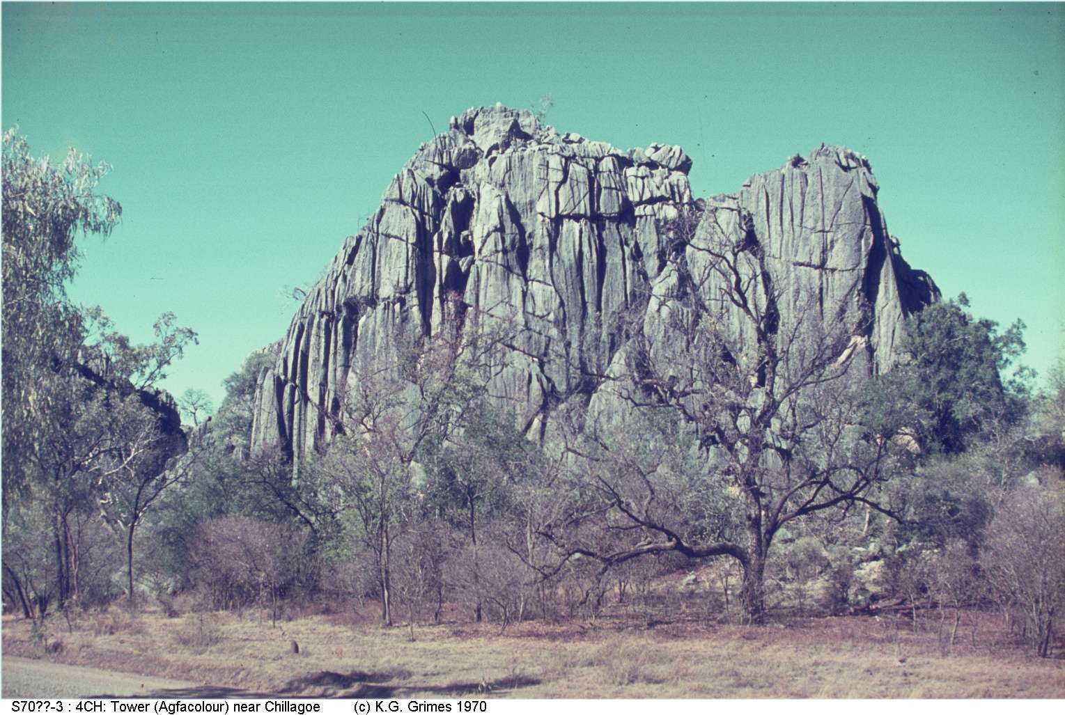
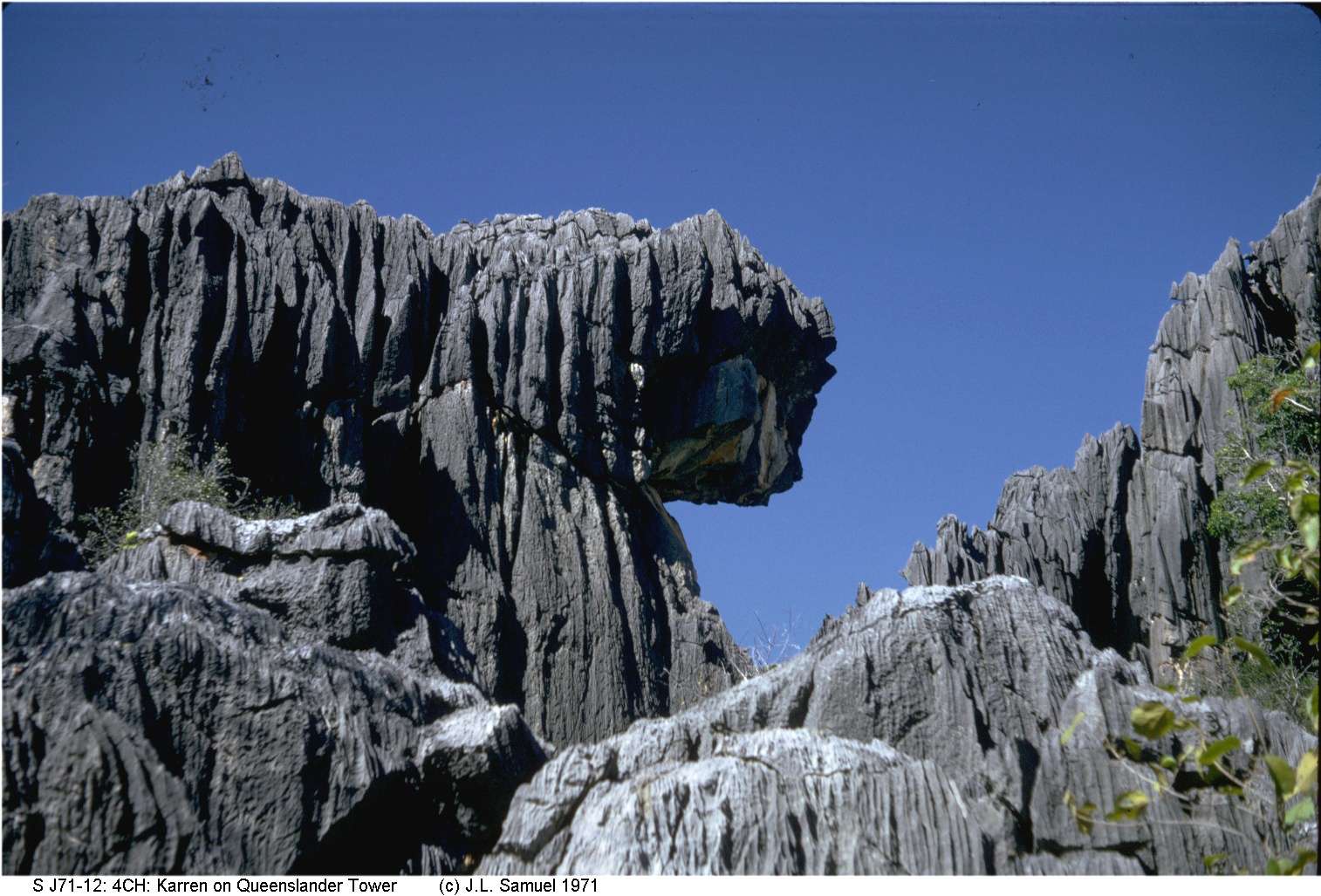
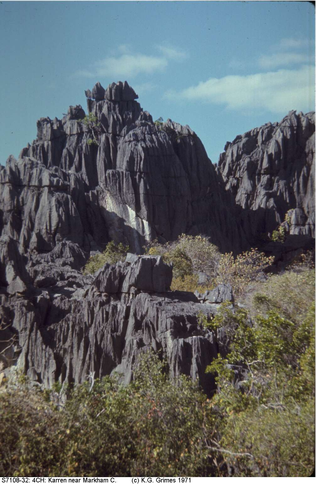
The steep-sided towers (known locally as "bluffs") can reach up to 90 m high, though most are less than 50 m, and are from 100 m to over a kilometre long. Their surfaces are deeply dissected by deep grikes, and have strongly developed vertical flutes and runnels. Many are surrounded by a limestone pediment or alluvium, but others rise immediately beside the contact with the surrounding (volcanic or sedimentary) rocks.
The towers are riddled with caves which are mainly mazes of phreatic chambers and vertical fissures (which may reach to the surfaces to make giant grikes). The fissures follow either joints or the vertical bedding. The cave floors are more-or-less horizontal and run at or just above the level of the surrounding pediment. A few rifts extend down as much as 15m beneath the level of the plain and these can hold permanent or seasonal lakes. During the wet season some caves are extensively flooded for several weeks at a time.
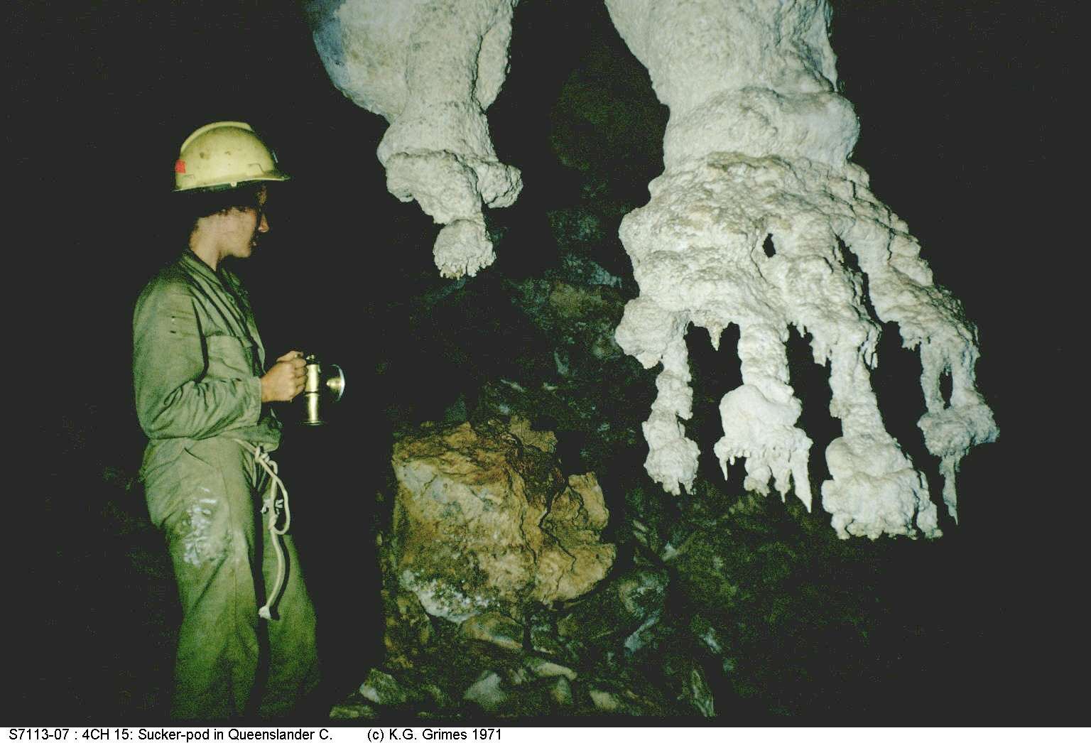
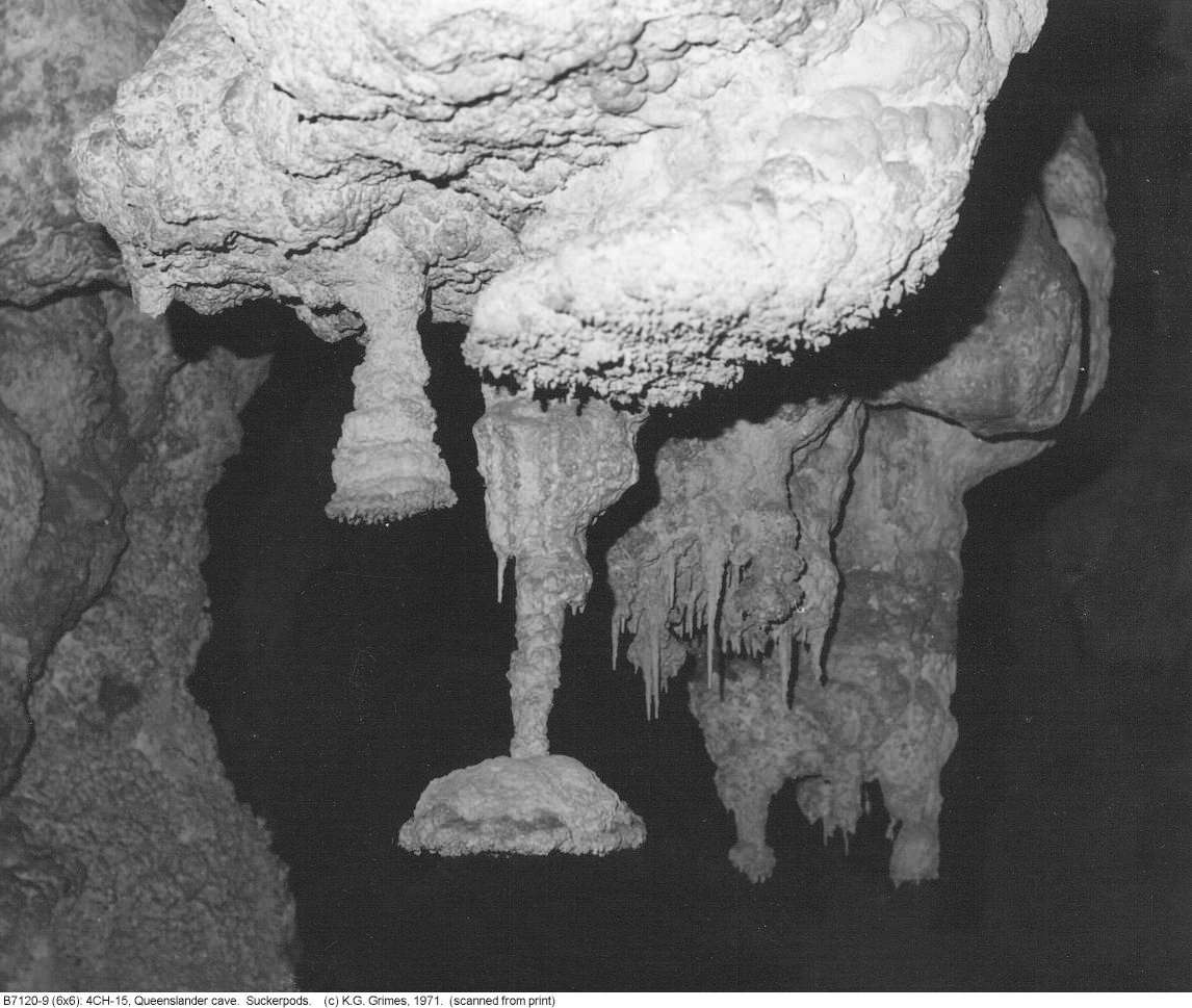
Speleothems are common. Cave coral is the most common form, but there are also some odd-looking stalactitic shapes (see photos below).

Cross-section showing steep-dipping rocks, the formation of marble near granitic intrusions, the different tower types (rounded on marble, steep on limestone) and a cave within a tower. The wet season flood levels, and the permanent water table are also shown.
|
A typical limestone tower at Chillagoe, with long deep runnels on the vertical faces. IMG00228.jpg |
|
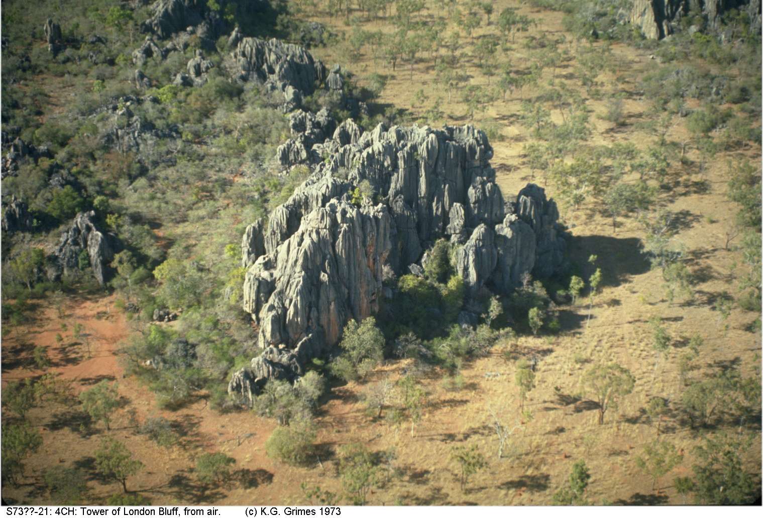
Tower of London Bluff, from the air. IMG00224.jpg |
|
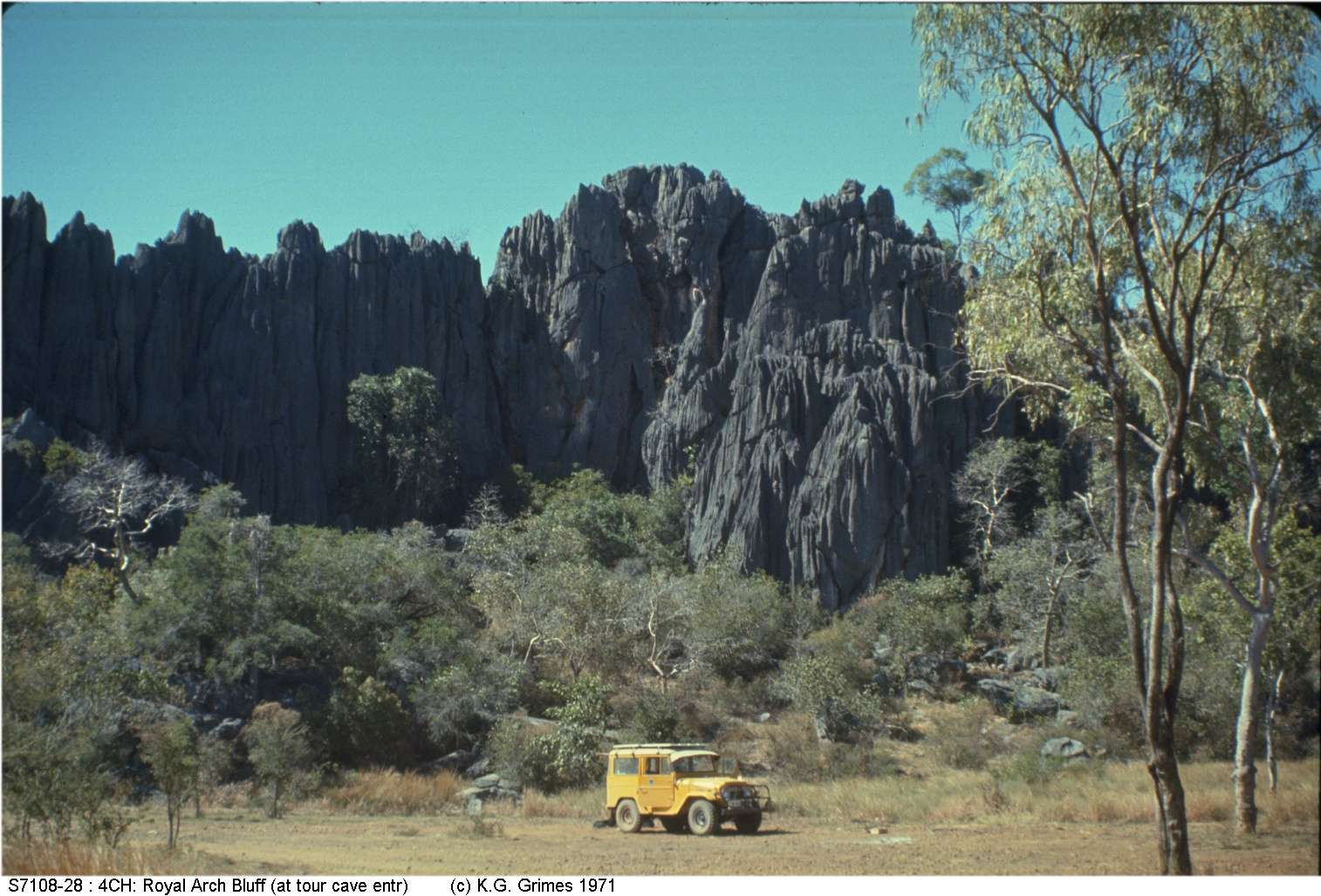
Royal Arch Bluff, which contains the main tourist cave in the area. IMG00227.jpg |
|
|
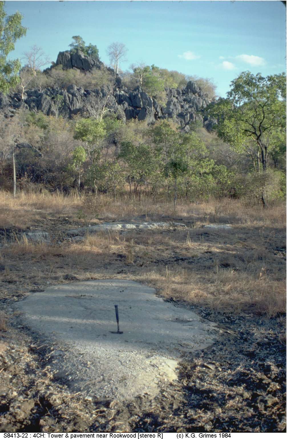
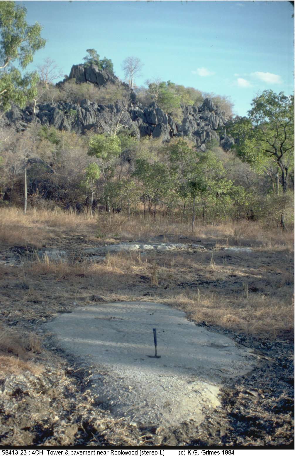
Stereopair showing flat limestone pediment surface with a low tower in the background (Mungana area). View stereopair cross-eyed. IMG00229.jpg, IMG00230.jpg |
|
A tower surface showing the strong karren sculpture. IMG00222.jpg |
|
Another view of the sculptured tower surfaces. IMG00223.jpg |

|
Map of Royal Arch Cave (from an SSS survey, 1969) |
|
"The Groping Hand", an unusual stalactitic formation in Queenslander Cave. IMG00231.jpg |
|
"Sucker Pads" in Queenslander Cave. B7120_9.jpg |
|
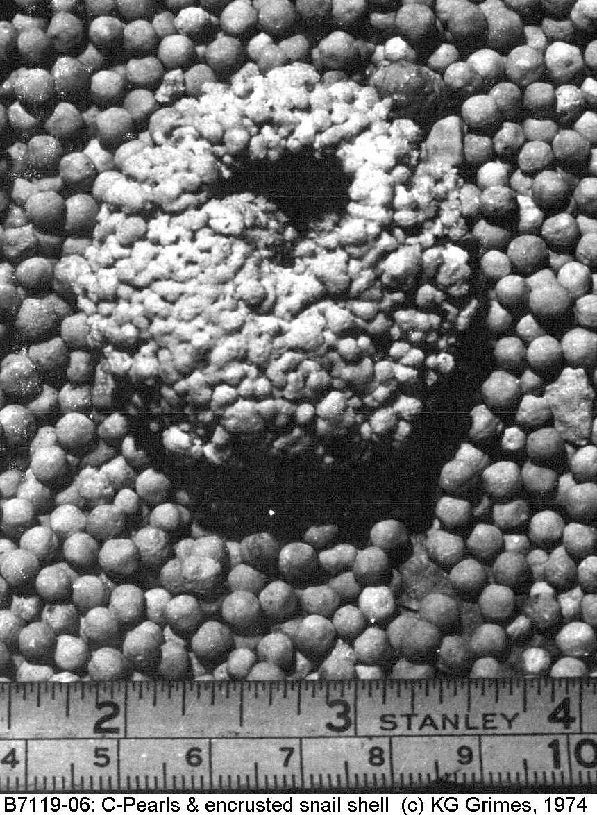
Cave Pearls and an encrusted snail shell. B7119_06.jpg |