Volcanic Caves of Queensland
Lava Tunnels are known from several late Cainozoic basalt provinces in north Queensland (e.g. the Undara volcano and others in the McBride Province; The BlackBraes and Barkers Crater lava caves in the Chudleigh Province; and several recent finds in the Nulla Province). They include several important bat maternity sites.
In southeast Queensland small tunnels occur in the Barambah Basalt and at Bauers Mountain (where a small lava tube is preserved in basalt dated at about 22-24 Million years). The caves in basalt at Bunyah Mtns and Natural Arch may be erosional features and not true lava tunnels.
Further readings
Webb, JA., Joyce, EB., Stevens, NC., 1993: Lava caves of Australia. Proceedings of the Third International Symposium on Vulcanospeleology. pp. 74-85.
Atkinson, FA., 1991: The Undara Lava Tube System, North Queensland, Australia. 6th International Symposium on Vulcanospeleology. National Speleological Society, Huntsville. pp. 95-120.
Atkinson, A. & Atkinson, V., 1995: Undara Volcano and its Lava Tubes. A & V Atkinson, PO box 505, Ravenshoe, 4872, Australia. 86 pp.
Stephenson, J., 1999: Emplacement and tube development in long tube-fed lavas in N. Queensland, Australia. Proceedings of the 9th International Symposium of Vulcanospeleology. Centro Speleologico Etneo, Catania. pp. 134-145.
Undara Lava Tube (McBride Volcanic Province)
The Undara lava flow formed 190,000 years ago and is 160 km long. Two major lava tubes can be traced as lines of surface hollows, visible on the geological map and landsat images below. The enterable lava tubes are discontinuous and, although large in diameter (up to 20m wide and 16m high), are generally of limited length - most are less than 200m long and the longest is 1350 m. None-the-less they are large spectacular tubes, and the lack of breakdown on the floors makes them easy to traverse. There is a major tourist operation based on them.
Selected photographs and diagrams
To view full size images, click on the displayed image.
|
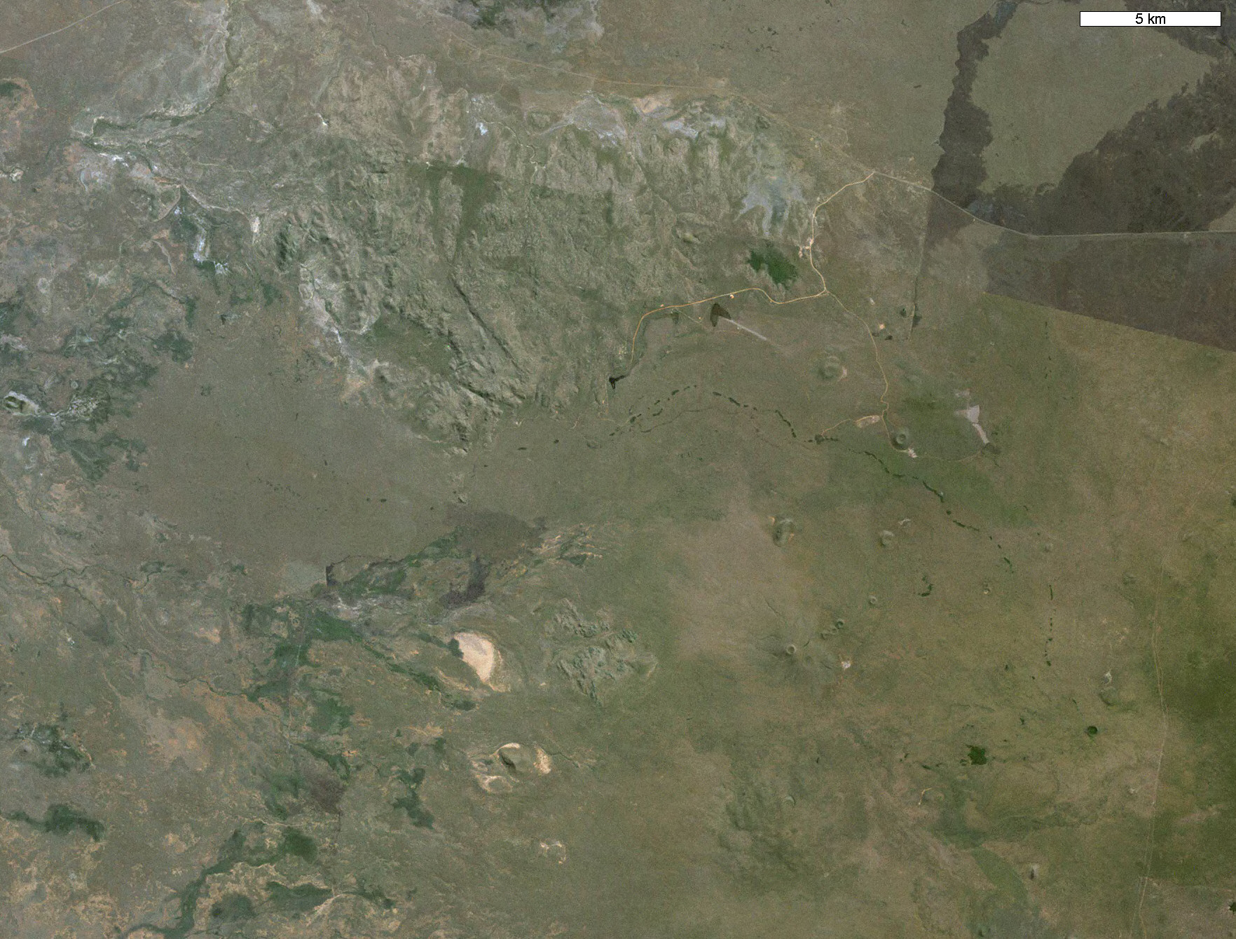
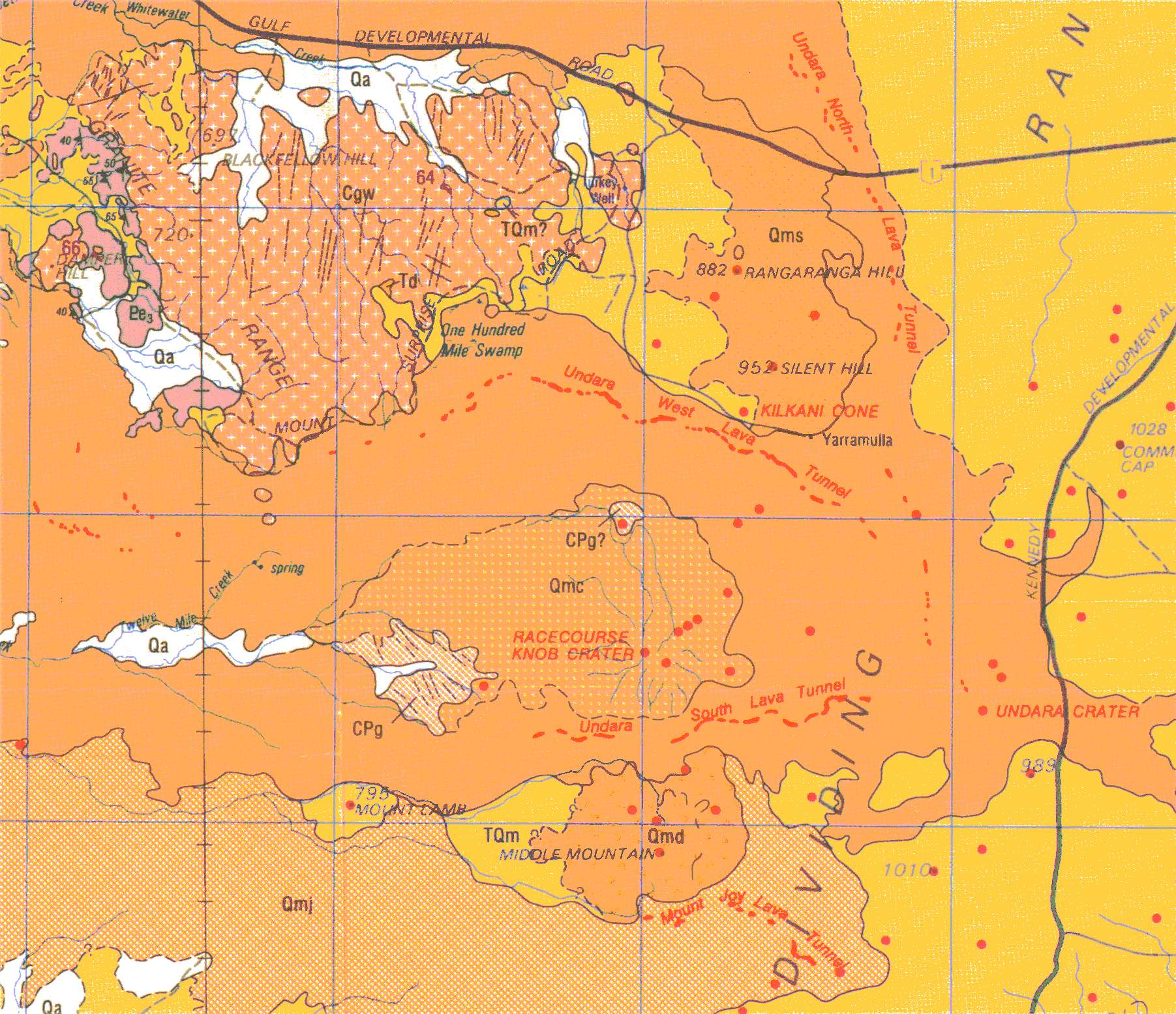
Geological map of part of the McBride Volcanic province of north Queensland.
From WITHNALL, IW., and GRIMES, KG. 1995: Einasleigh (second edition), 1:250,000 geological map and Explanatory Notes. Geological Survey of Queensland, Sheet SE55-9.
Filled red circles are volcanic centres. The lines of smaller red dots are depressions that trace the major lava tubes, but not all these are drained and open. Most of the open tubes are in the "Undara West Lava Tunnel".
Grid squares are 10 km.
|

|
Landsat image of part of the Undara lava flow (click it for a larger view).
Dark dots and lines are the vegetated hollows along the line of the major lava tubes.
|
|
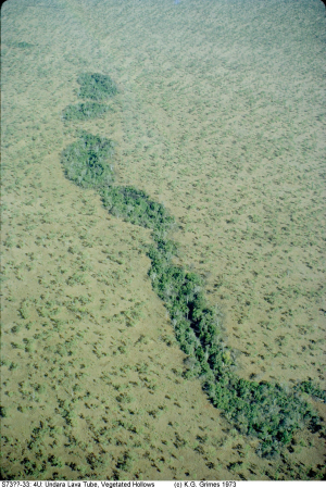
Aerial view of part of the Undara West Lava Tube - shown by the line of hollows with vine thicket vegetation.
These correspond to the lines of red spots on the geological map
These big hollows seldom have entrances to the lava caves and are thought to have been lava ponds. The caves are nearby but reached through smaller collapse dolines that are less obvious.
IMG00024.jpg |
|
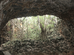
4U-22, The Arch, Showing vine thicket vegetation in a collapse doline.
D030493s.jpg |
|
4U-44, Mikoshi Cave, A large but short daylit lava tube, with linings.
D030466s.jpg |
|
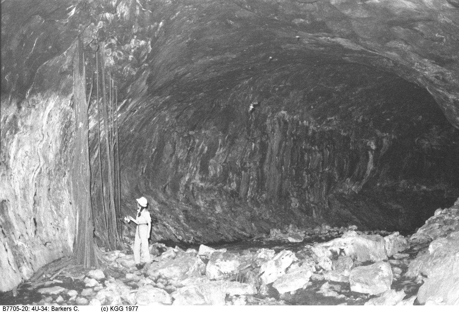
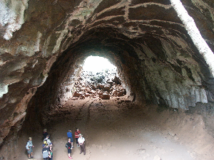
Part of Barkers Cave, 4U-34, the best known of the caves at Undara.
IMG00006.jpg |

|
Another view of Barkers Cave, with tree roots.
IMG00168.jpg |

|
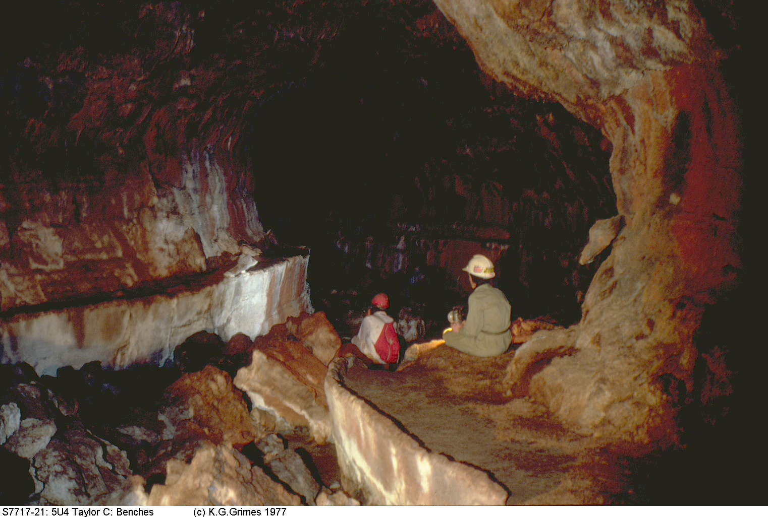
Taylor Cave (4U-4), showing well-developed benches on the side of the tube.
IMG00012.jpg |
Black Braes area (Chudleigh Volcanic Province)
See PDF file of my report in Down Under: Grimes 1977

|
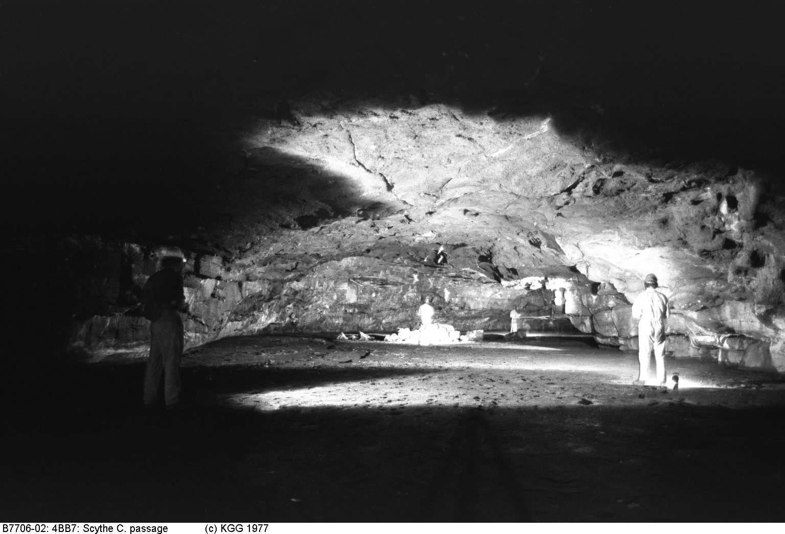
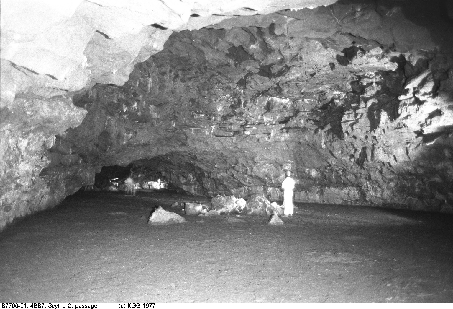
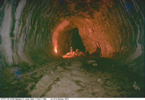
4BB-7, Scythe Cave, is in the Black Braes area of the Chudleigh Volcanic Province, about 100 km south of Undara.
IMG00173.jpg |

|
Another part of Scythe Cave, Black Braes.
IMG00172.jpg |
Go to Main Index menu