Ecosystems at Risk: Limestone caves
4c. Catchments
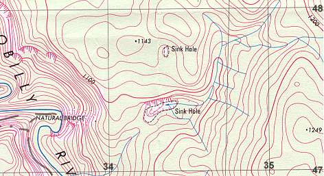
Karst is the term used for the distinctive landforms of catchments
on limestone and other soluble rocks. Karst landforms are formed by solution
processes and are characterised by underground drainage where water has
dissolved the rock forming caves but the general surface landform is dominated
by gorges and sink holes which capture surface streams leaving dry valleys.
The topographic map below displays some of these features with a gorge
in the area of the Natural Bridge (a cave where all of the Yarrangobilly
River runs through a hillside) and sink holes capturing creeks.
|
|||||||||||||||
 |
|||||||||||||||
 |
|||||||||||||||
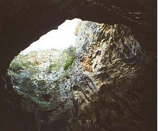
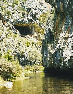
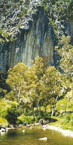
| Above: Gorge and cave just upstream of the Natural Bridge. Right: Gorge downstream of the map area. The Yarrangobilly River has formed the gorge by cutting through the limestone bedrock through the processes of dissolving the limestone (chemical weathering), undercutting the gorge walls on the outside of meanders and the removal of material by the river (erosion). | |||||||||||||||
|
|
|||||||||||||||
|
|||||||||||||||