Limestone
Caves
2c.
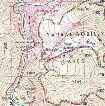
Yarrangobilly
Caves:
vertical air photo and topographic map
 |
 |
||||||||||||||
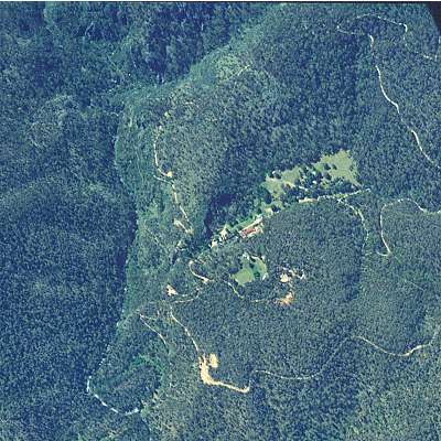
| Vertical aerial photograph of the main tourist areas of the Yarrangobilly Caves system. Source of air photo and topographic map: © Land and Property Information Panorama Avenue Bathurst 2795 |
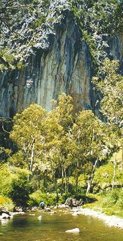
Gorge at top left of photo. |
||||||||||||||
|
|||||||||||||||