Sandstone Karst at Lawn Hill Gorge
The main karst interest at Lawn Hill gorge is the Colless grikefield in the Cambrian dolomites upstream from the main sandstone gorge [link]. However there is also an area of sandstone pseudokarst or parakarst to the northeast of the main gorge. This is opposite the gap where Widallion creek cuts through the Constance Range. At the edge of the main plateau there is a spring at the base of the scarp that lies directly beneath a hanging valley.
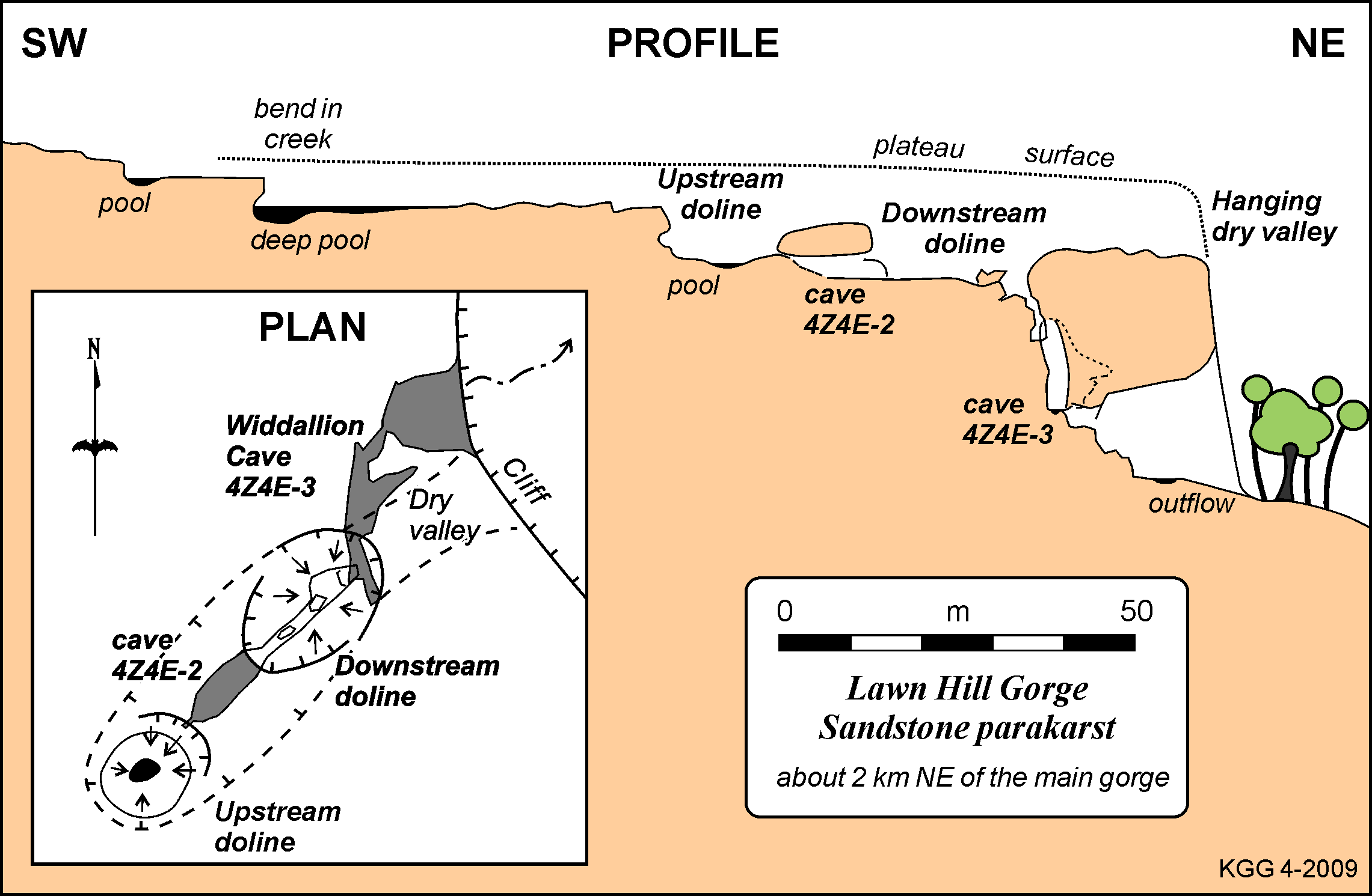
A small stream, about 1 km long, runs across the plateau and becomes incised as it approaches the scarp and ends in two large closed depressions in the hanging valley above the 30-50m high cliffs. There is a spring, with small outflow channel, directly below at the foot of the cliffs (see profile below). The upstream (SW) depression is cup shaped, with a solid rock floor and a small pool. It is about 15m across and has a downstream closure of 5m and a 10m cliff on the upstream side. On the downstream side a small impenetrable hole opens into a narrow cave with a T-section which leads through the intervening ridge to the second depression. This is more funnel shaped and contains a number of large fallen blocks. It is about 20m across and 10m deep. This doline is about 20m from the cliff edge and separated from it by a dry hanging valley.
The main cave is a set of descending fissures that are aligned parallel to the cliff. It has pools and there was a small flow through parts of it in June 2008. Wet season flows would be much stronger. At the bottom it opens out into a large daylight chamber with a small stream (the spring) running out of it.
Immediately to the north there is another hanging valley, and a small area of "stone city" in jointed sandstone.
The Constance Sandstone is porous and makes a good aquifer - numerous springs occur along the sandstone escarpment to the north of here. The pseudokarst may be the result of spring sapping and piping working upwards from the base of the cliffs; possibly aided by solution of the quartz cement of the sandstone (ie parakarst).
Selected photographs and diagrams
To view full size images, click on the displayed image.
|
|
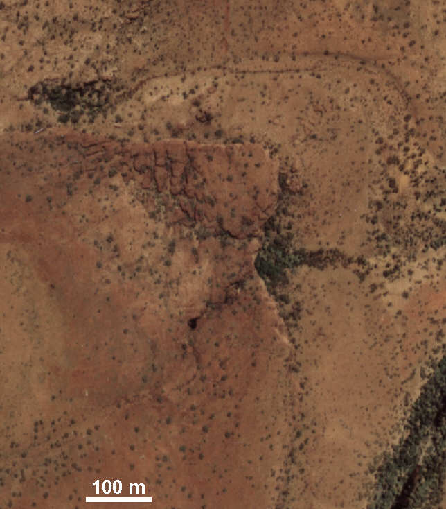
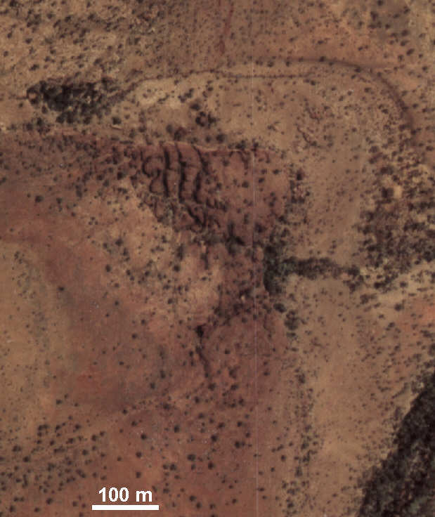
Vertical air-photos of the sandstone plateau, the hanging valleys, and the spring. Note also the second valley to north and the small patch of "stone city" joint-blocks.
Stereopair - view cross-eyed.
NB: You will need to open the two photo files in a photo-software package and zoom in to see the detail in stereo.
Musselbrook, 1972, 1:25,000 air photos, Run 5, frames 27 & 28.
Filenames are: Musselbrook.5.27.x.jpg and Musselbrook.5.28.x.jpg |
|
Profile of the hanging valley and its closed depressions, with a sketch map of the cave and two main dolines.
LHG-Profile.png |
|
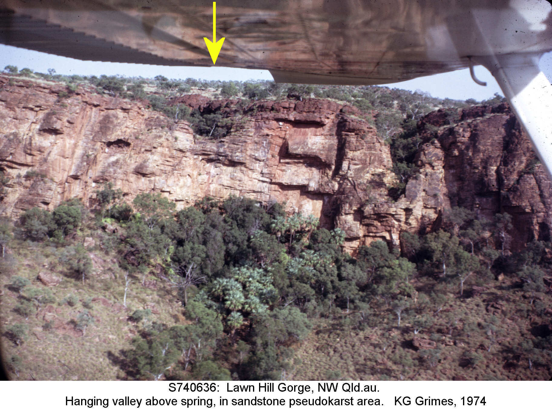
The escarpment with the hanging valley (arrowed) and the spring below. There is a second, deeper, hanging valley to the north (right), which has not been explored.
S740636t.jpg |
|
|
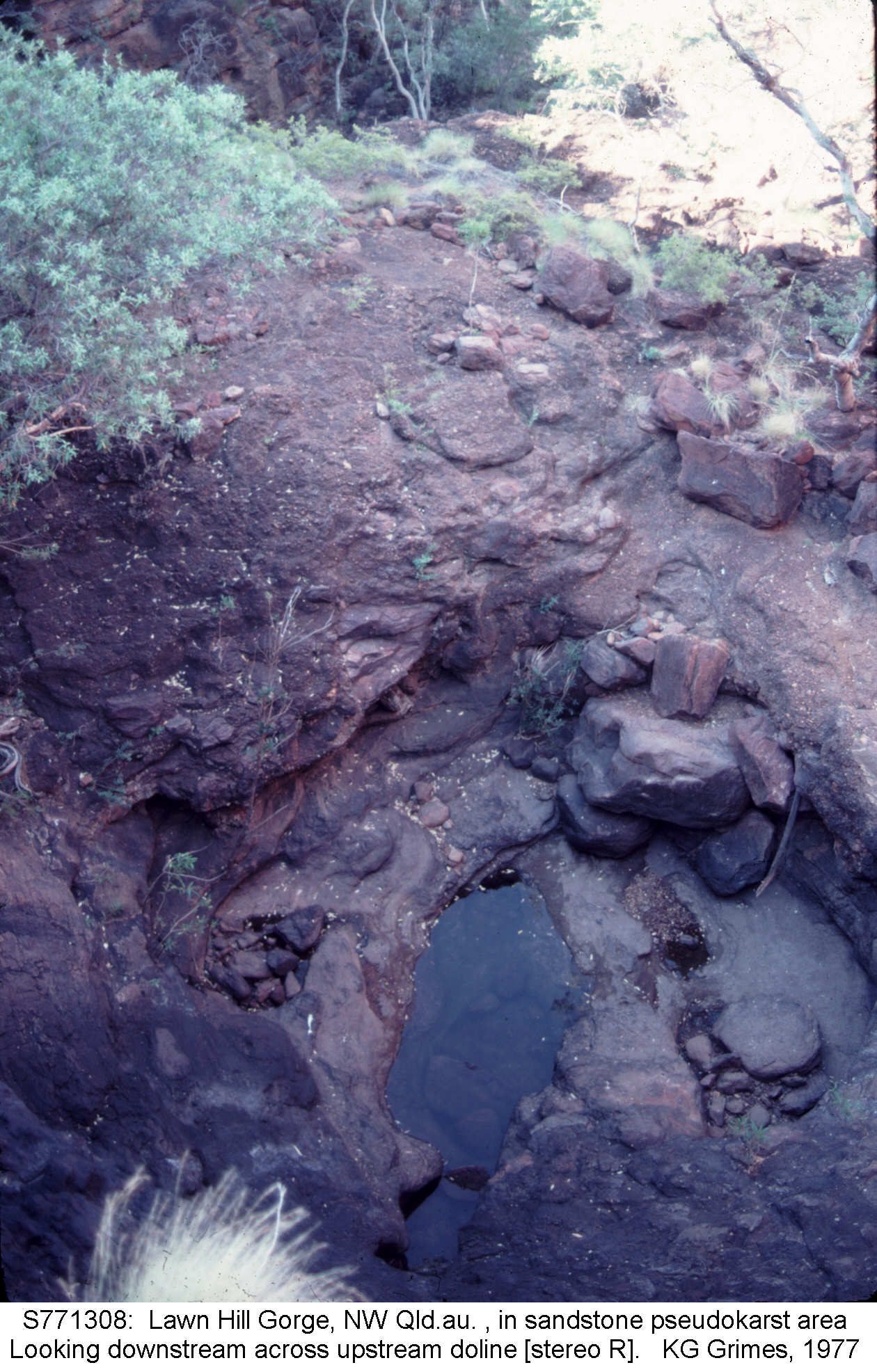
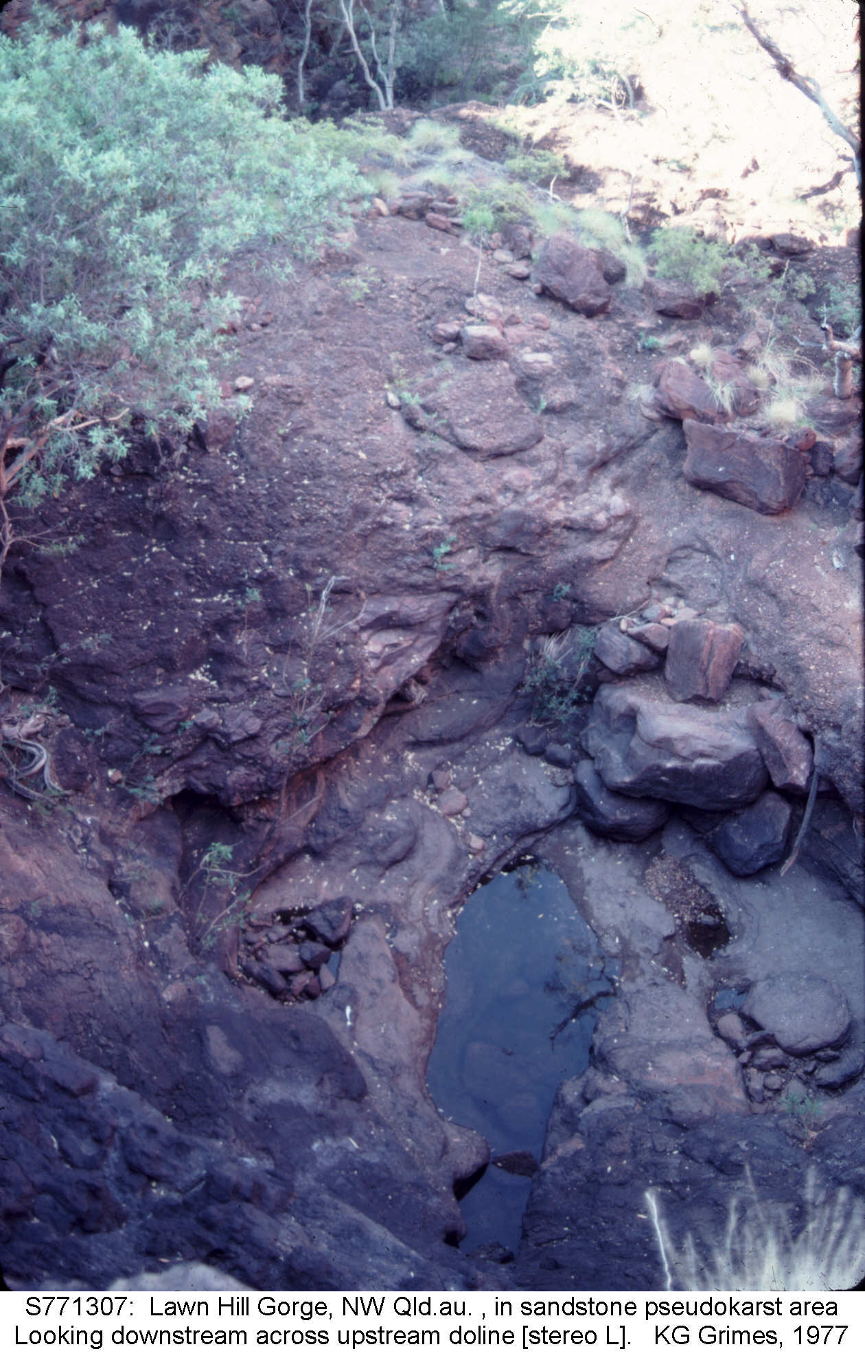
Looking downstream across the floor of the upstream doline. The edge of the second doline is just visible beyond it.
Stereopair, view cross-eyed.
S771307.jpg and S771308.jpg |
|
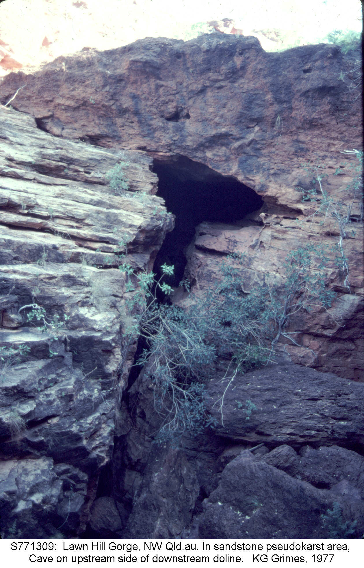
Looking upstream at the entrance of the small cave that runs between the two dolines.
S771309.jpg |
|
|
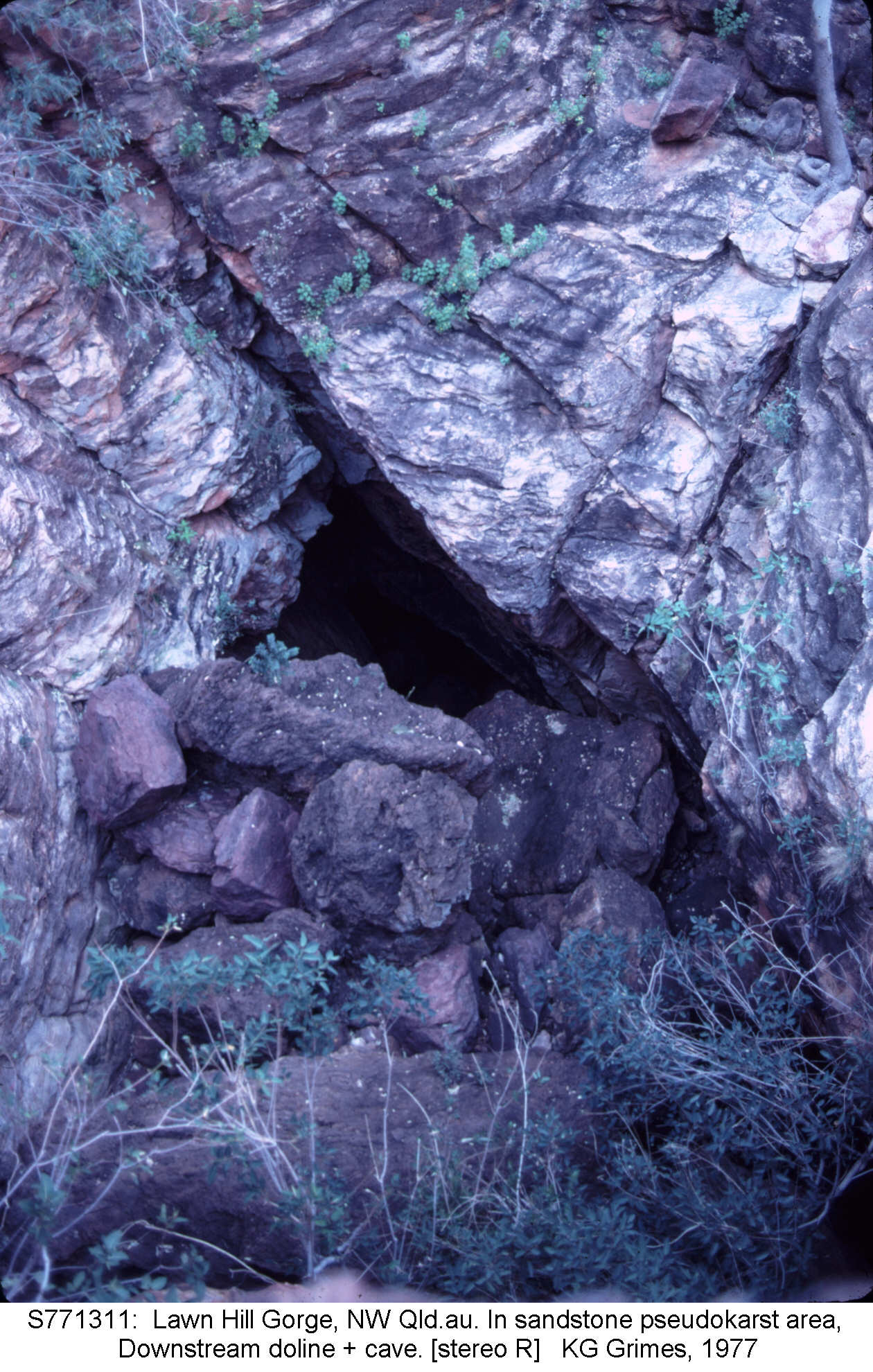
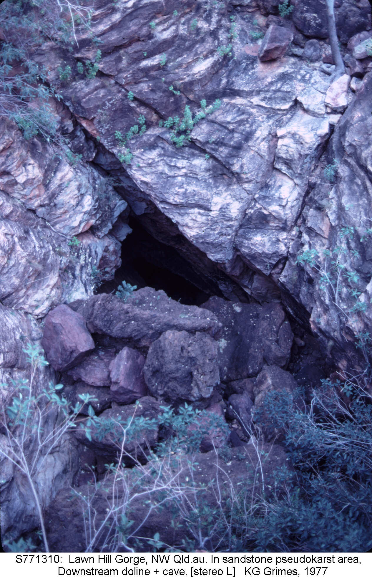
Downstream doline, looking into the entrance of the cave shaft.
S771310.jpg and S771311.jpg |
|
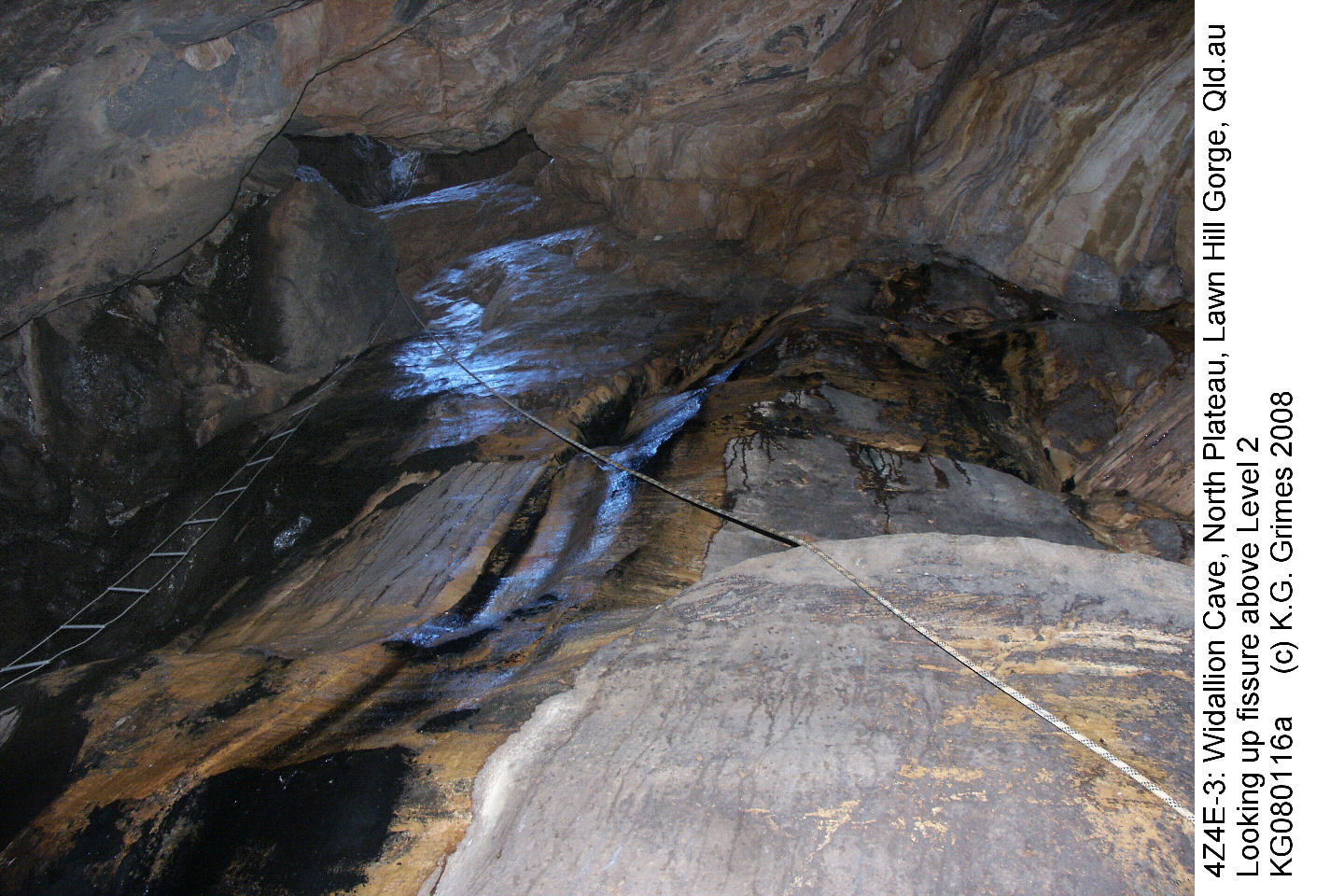
Inside the cave, looking up one of the fissures. Note thin water flow.
KG080116as.JPG |
Go to Main Index menu