Volcanic Caves of Victoria (Overview)

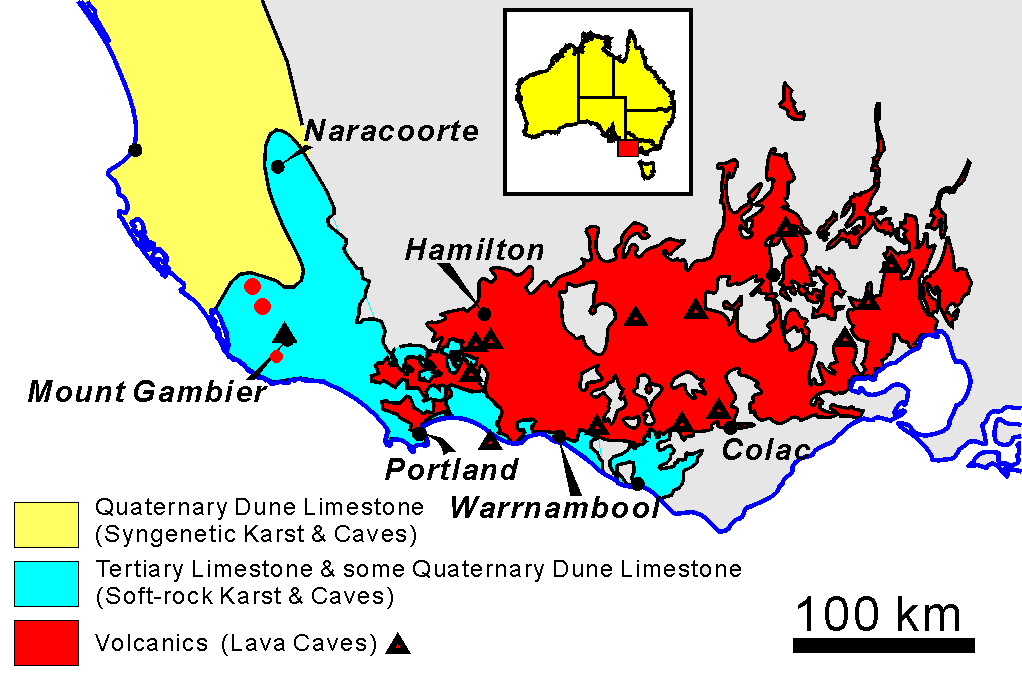
Map of the Newer Volcanic Province of Victoria and South Australia.
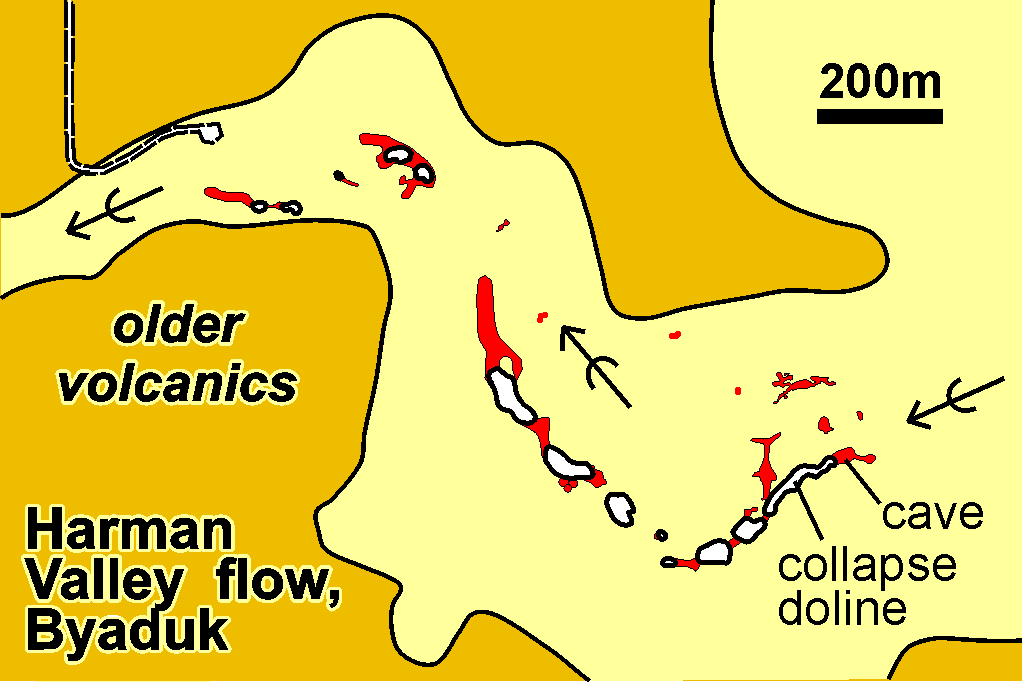
Detail of the younger flows in the western part of the province: Mt. Napier (33 ka), Mt. Eccles (~27 ka) and Mt. Rouse (~400 ka).
Most of the caves in the region are found in the Mt Napier and Mt. Eccles flows.
The Byaduk Caves are a cluster of large and small tubes, occurring where the lava flows spreading out from Mt Napier enter the Harman Valley and follow it west for about 20 km.
Click here for a set of interpretive Signs for the area

Selected photographs and diagrams

  • Large Tubes
  • Small subcrustal caves
  • Contents of lava caves
  • Surface features
    Specific Caves
  • Natural Bridge (3H-10) formed in a lava channel by overgrowth of levee banks
  • Carmichael Cave (3H-70) is a complex sub-crustal cave at Mt Eccles
  • The Theatre (3H-33) is a multi-level system at Byaduk
  • Mt Hamilton Lava Cave (3H-2) is an evolved sub-crustal cave with larger tunnels
  • The Shaft (3H-8) An open volcanic vent

  • Interpretive Signs for the Volcanic Trail

    Go to Main Index menu