S9211-02.jpg
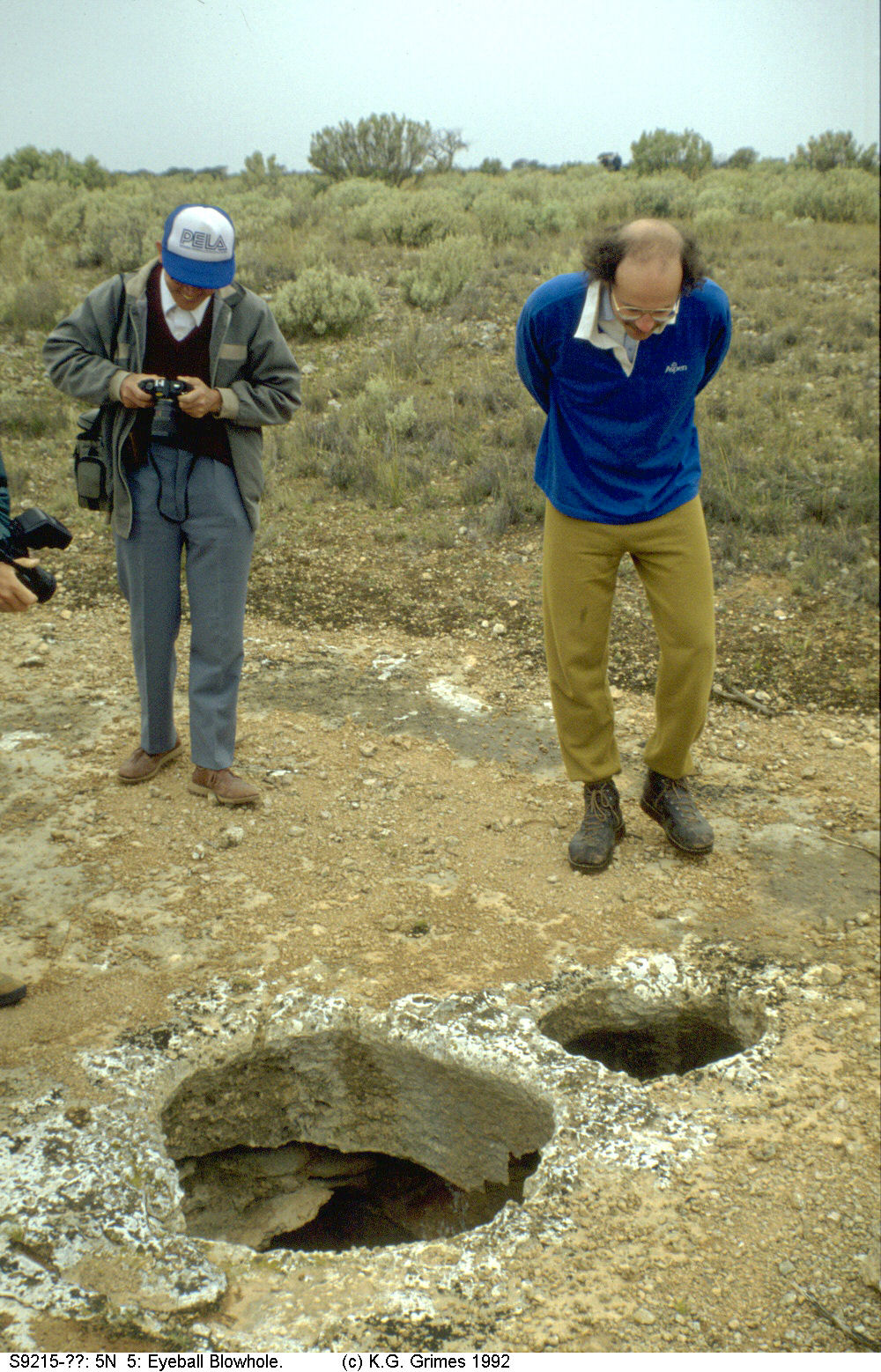
There are numerous blowholes: small shafts a few metres deep that connect to either shallow caves or to a zone of spongework. These breath in or out according to the barometric pressure. Winds up to 70 km/h have been measured. [photo]
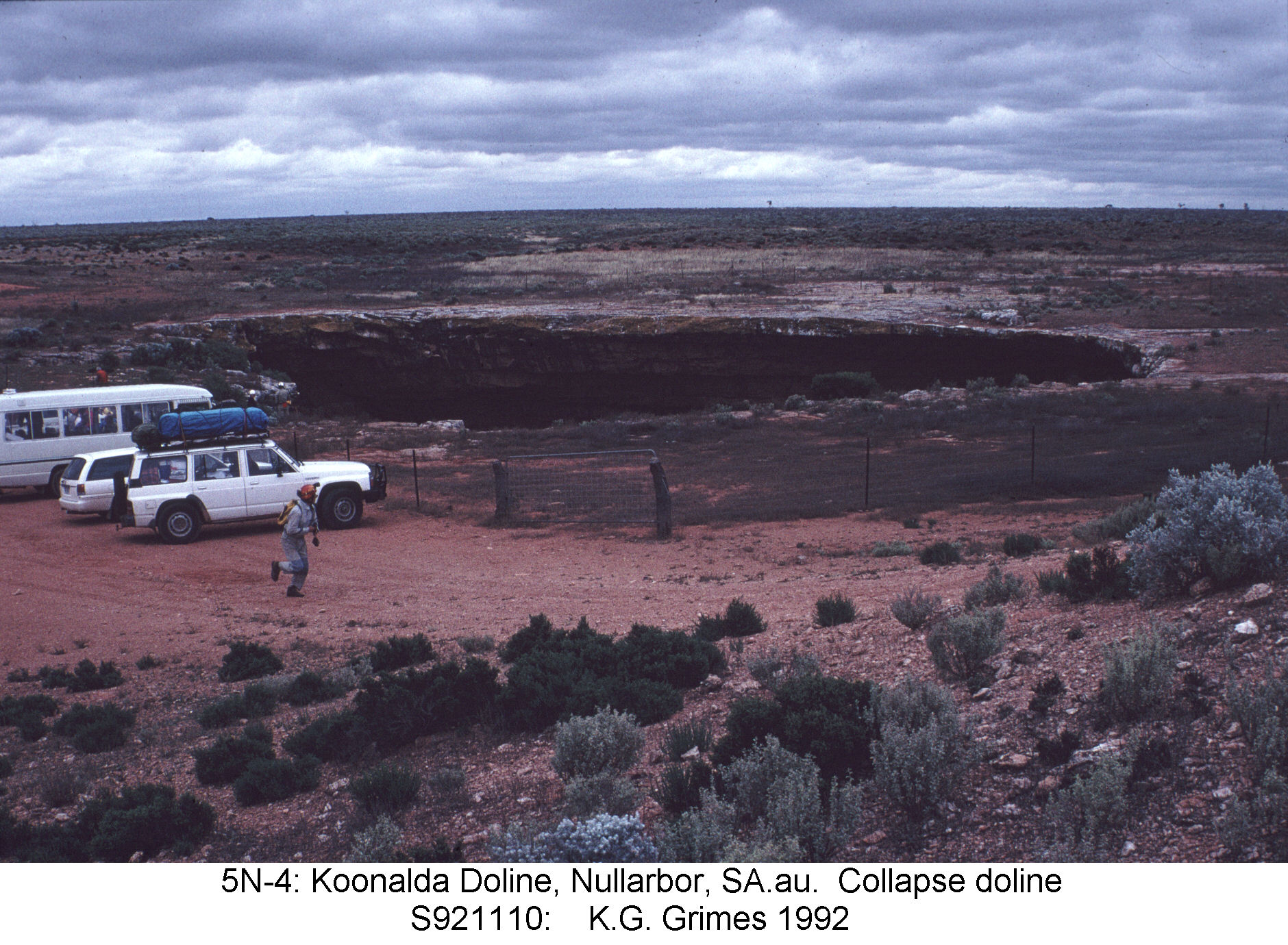
Collapse Dolines are found only in the southern part of the plain, mostly within 60 km of coast. These are large, deep, and steep sided, and connect to caves at various depths, including the deep systems. [PHOTO Koonalda]
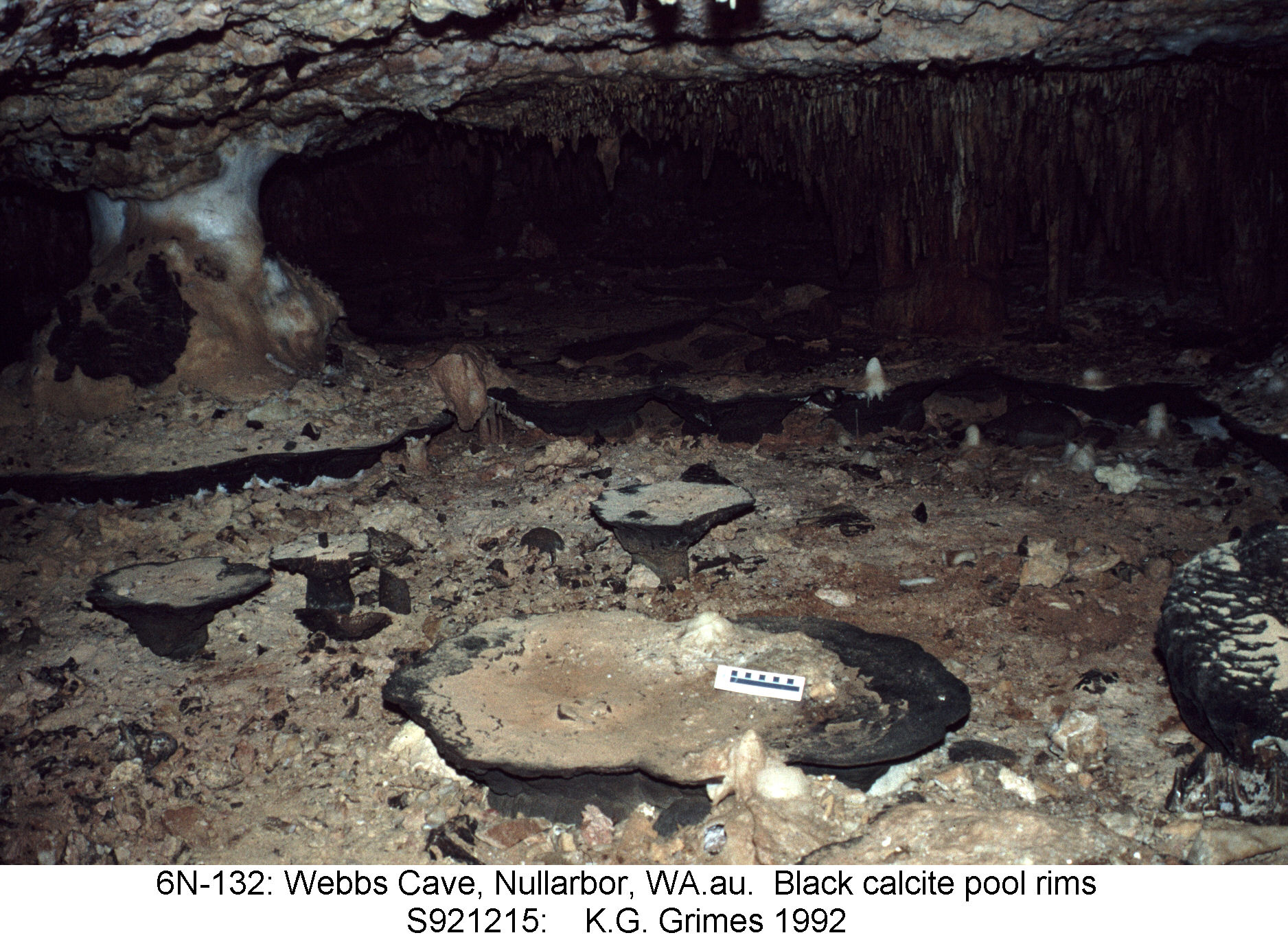
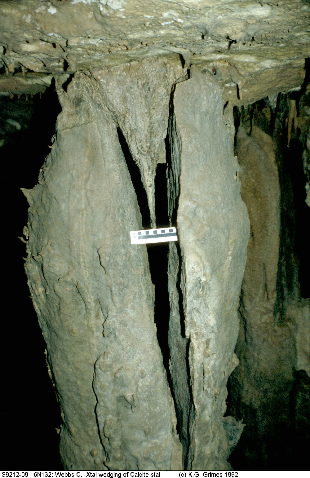
The arid climate, coupled with the breathing which desiccates the cave air, produces a variety of minerals: gypsum, halite, etc. There are also ancient black calcite speleothems, dating from the wetter Tertiary period, which are being broken up by crystal growth of the younger gypsum and halite minerals.
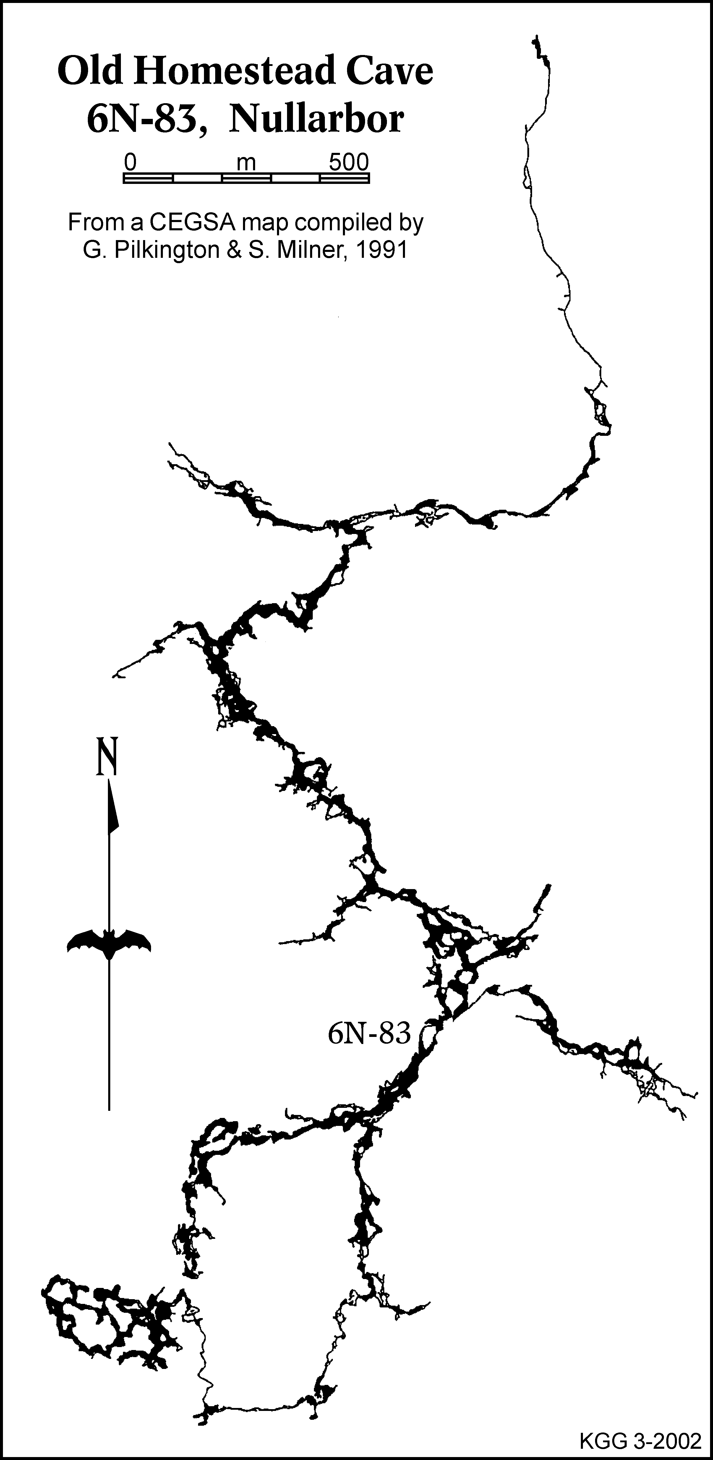
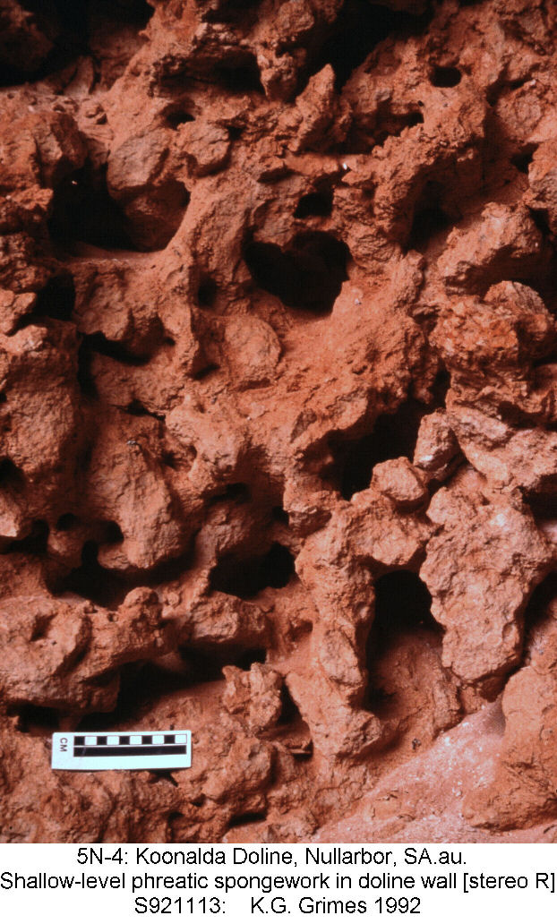
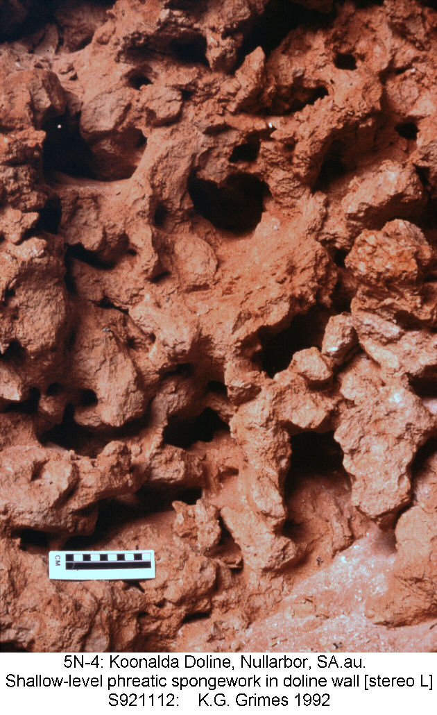
This near-surface spongework was thought to be phreatic and dating from past higher watertables, but James et al (2005) and Webb & James (2006) suggest that it could be a recent vadose effect resulting from the rare rain storms. Within the spongework zone there are many shallow caves. At greater depth, but still above the present watertable are larger systems such as Old Homestead Cave (with ~30 km of passage) and Thampanna Cave - these show extensive phreatic sculpturing.
In the southern part of the plain there a many deep, steep-walled collapse dolines, which connect to large deeper cave systems, that have large watertable lakes and extensive sections of flooded passage. [see below and http://www.trimixdivers.com/index.html for additional diver's maps etc]. These caves have been extensivly modified by collapse and crystal weathering.
James, J.M., Contos, AK., & Barnes, CM., 2005: Nullarbor Caves, Australia. in Culver, DC. & White, WB., [eds] Encyclopedia of Caves. Elsevier, Amsterdam, pp. 418-426.
Lowry, DC. and Jennings, JN., 1974: The Nullarbor Karst, Australia. Zeitschrift fur Geomorphologie 18(1): 35-81.
Webb, J.A., Grimes, K.G., & Osborne, R.A.L., 2003: Black Holes: Caves in the Australian Landscape. in Finlayson, B. & Hamilton-Smith, E. (eds.) Beneath the Surface: A Natural History of Australian Caves. Sydney: UNSW Press. pp. 1-52.
Webb, JA, & James, JM., 2006: Karst evolution on the Nullarbor Plain, Australia, in Harman, RS & Wicks, C [eds] Perspectives on karst geomorphology, hydrology and geochemistry. Geological Society of America, Special Paper 404: 65-78.
|
|
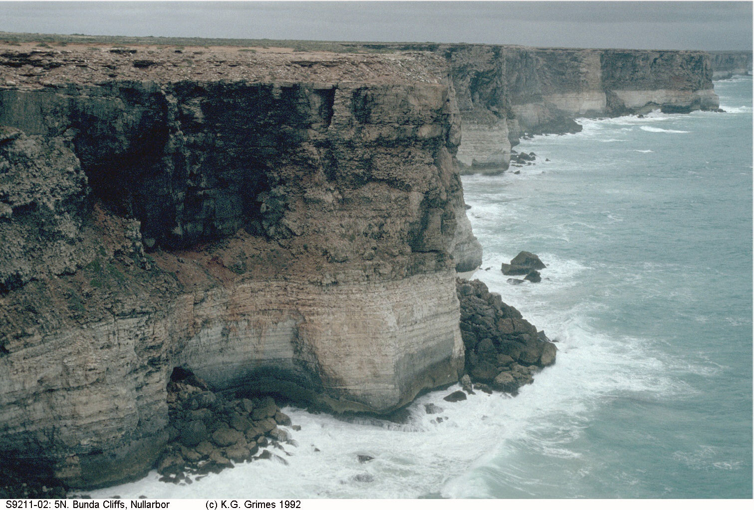
At the ocean edge of the plain, the Bunda Cliffs run as an unbroken vertical scarp for 200 km with a height between 40 and 100m. S9211-02.jpg |
|
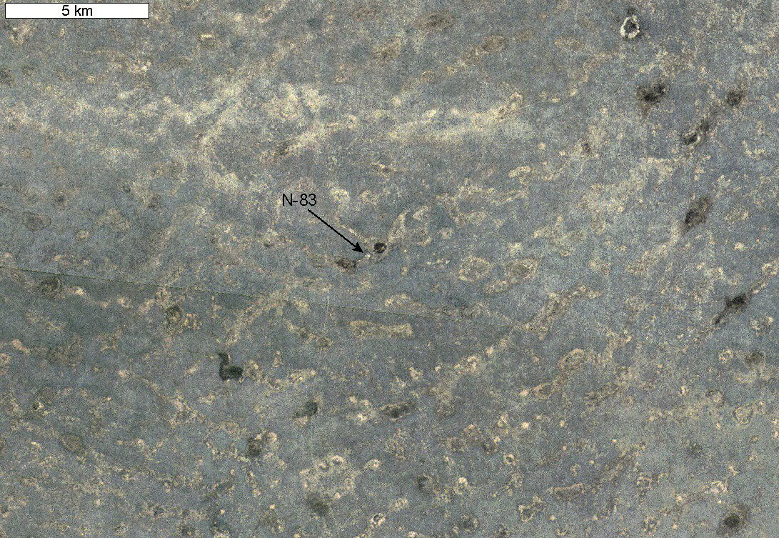
Landsat image of the central Nullarbor Plain in the vicinity of Old Homestead Cave (6N-83). Even grey is saltbush on broad rises, pale & darker patches are shallow "dambo" hollows. Click the image to see a broader view 6N83.at.jpg |
|
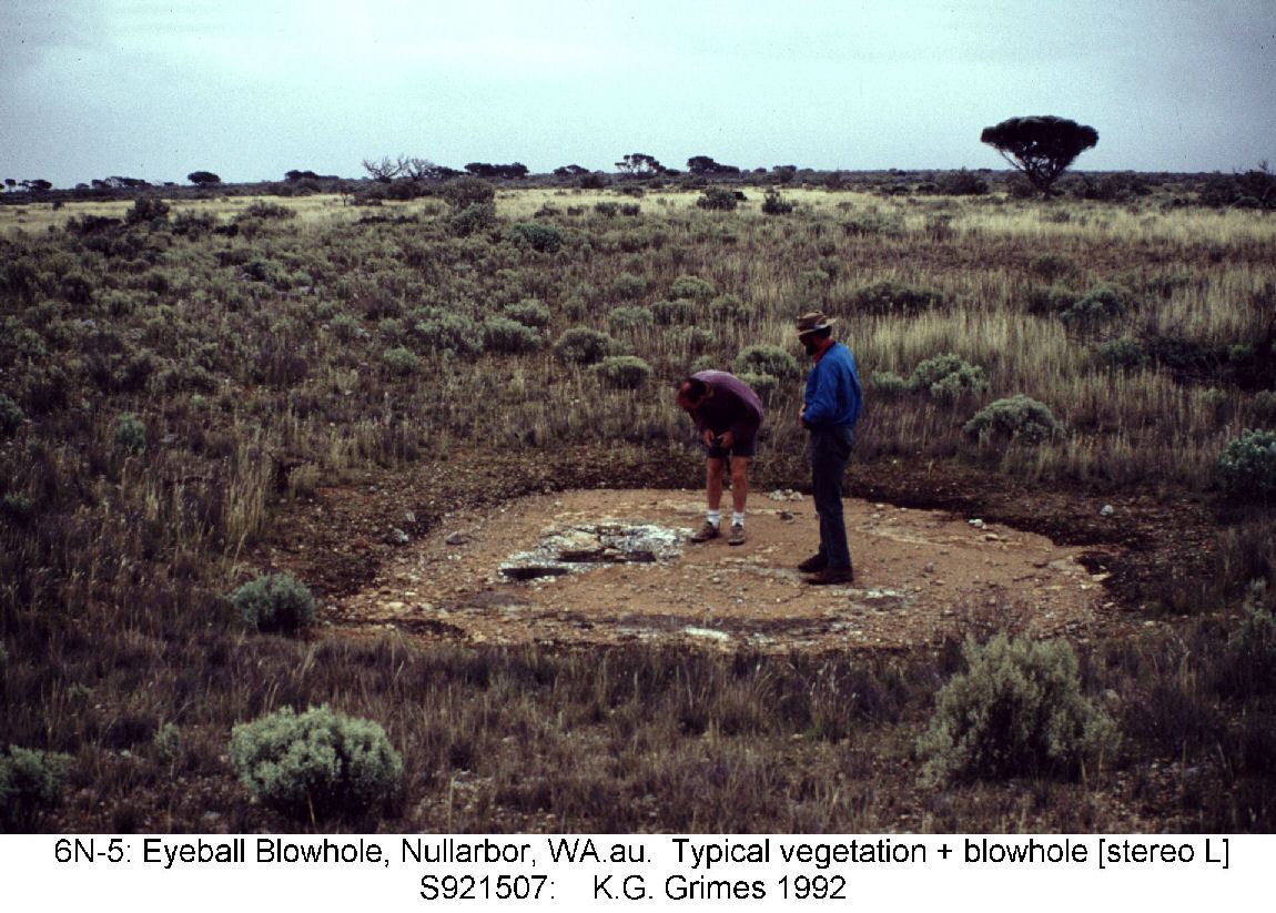
Typical saltbush vegetation on the plain. The bare patch is exposed calcrete in a small "donga" developed around a blowhole.
S921507.jpg |
|
Blowholes are a common features of the surface of the plain. They are vertical shafts which may connect to small shallow caves, though most just end in a fine impenetrable spongework. They "blow" or "suck" according to the barometric pressure. Note the saltbush vegetation in the background. S921512.jpg |
|
Map of Old Homestead Cave (6N-83). The cave is an extensive horizontal phreatic system developed on two levels, lying about 63 metres and 70 metres below the plain. The passages often show strong phreatic sculpturing (see photo below). 6N-83.Map.png |
|
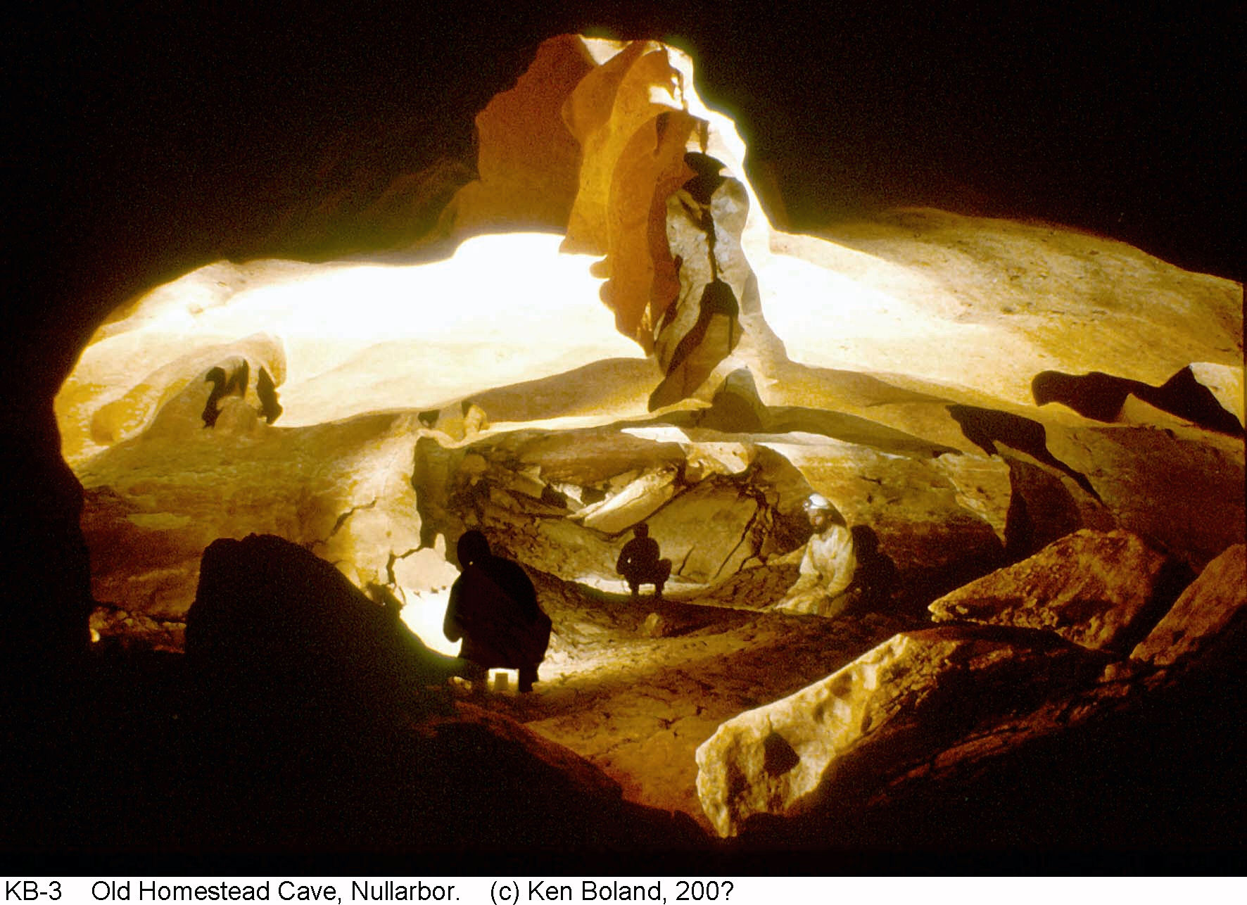
Phreatic sculpture in a passage in Old Homestead Cave Photo by Ken Boland KB-3.c.jpg |
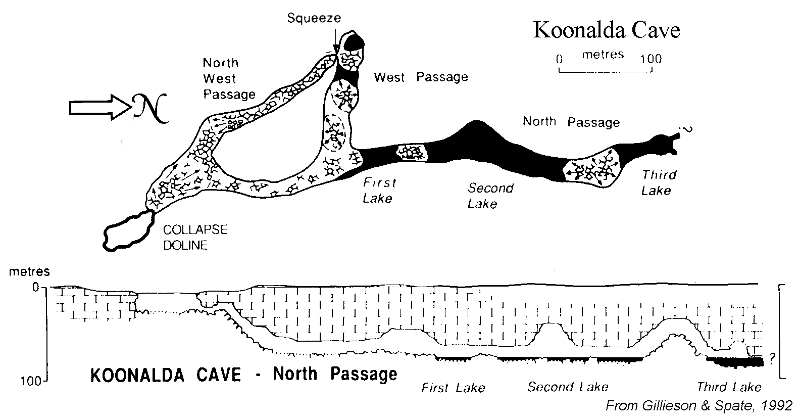 | Map of Koonalda Cave, showing watertable lakes. |
|
Collapse doline of Koonalda Cave |
|
|
Shallow-level spongework exposed in the wall of Koonalda Doline (5N-4D). Stereo-pair - view cross-eyed. S921113.jpg & S921112.jpg |
|
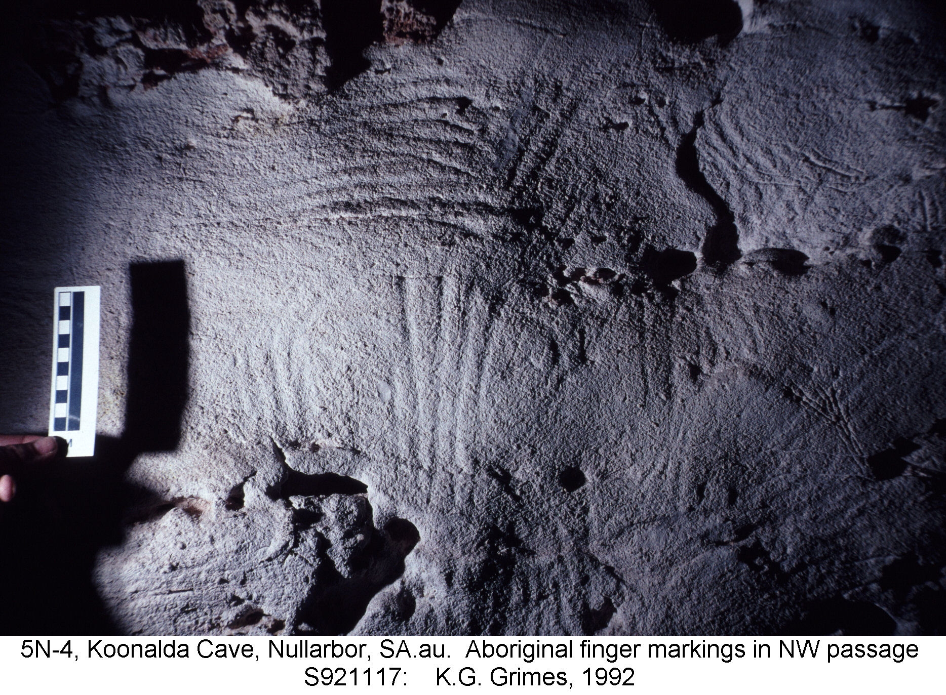
Aboriginal finger markings in area of chert mining, NW Passage of Koonalda Cave. S921117.jpg |
|
|
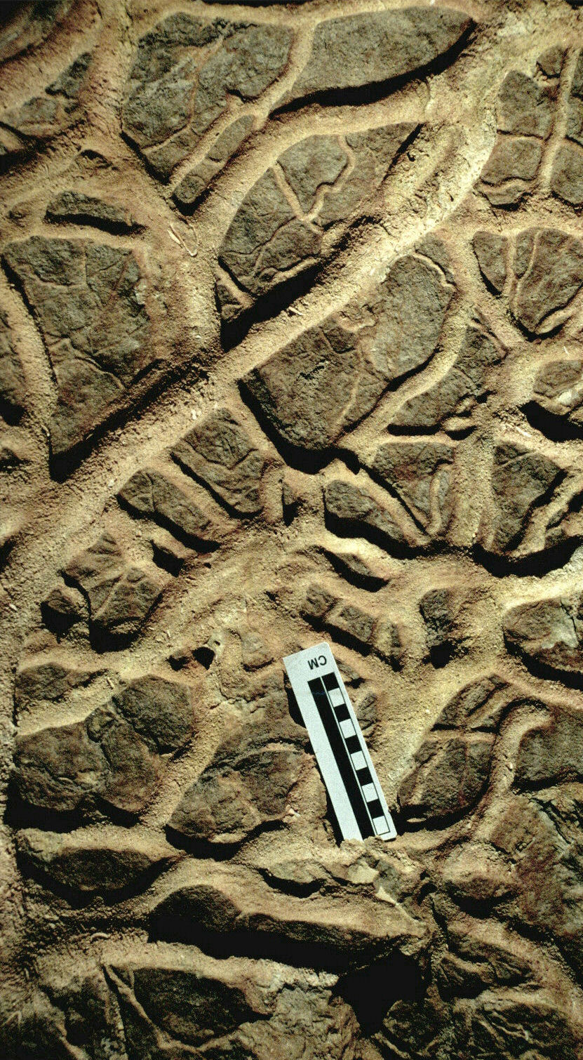
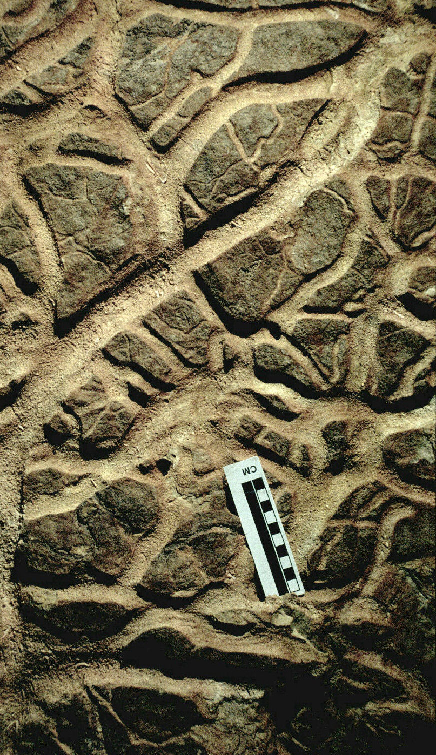
Anastomosing half-tubes exposed along a bedding plane that has fallen from the ceiling, Webbs Cave. Stereo-pair - view cross-eyed. S9212-14.jpg & S9212-13.jpg |
|
Old black calcite pool speleothems, in Webbs Cave (6N-132) S921215.jpg |
|
Calcite speleothem cracked open by crystal wedging. Webbs cave. S9212-09.jpg |