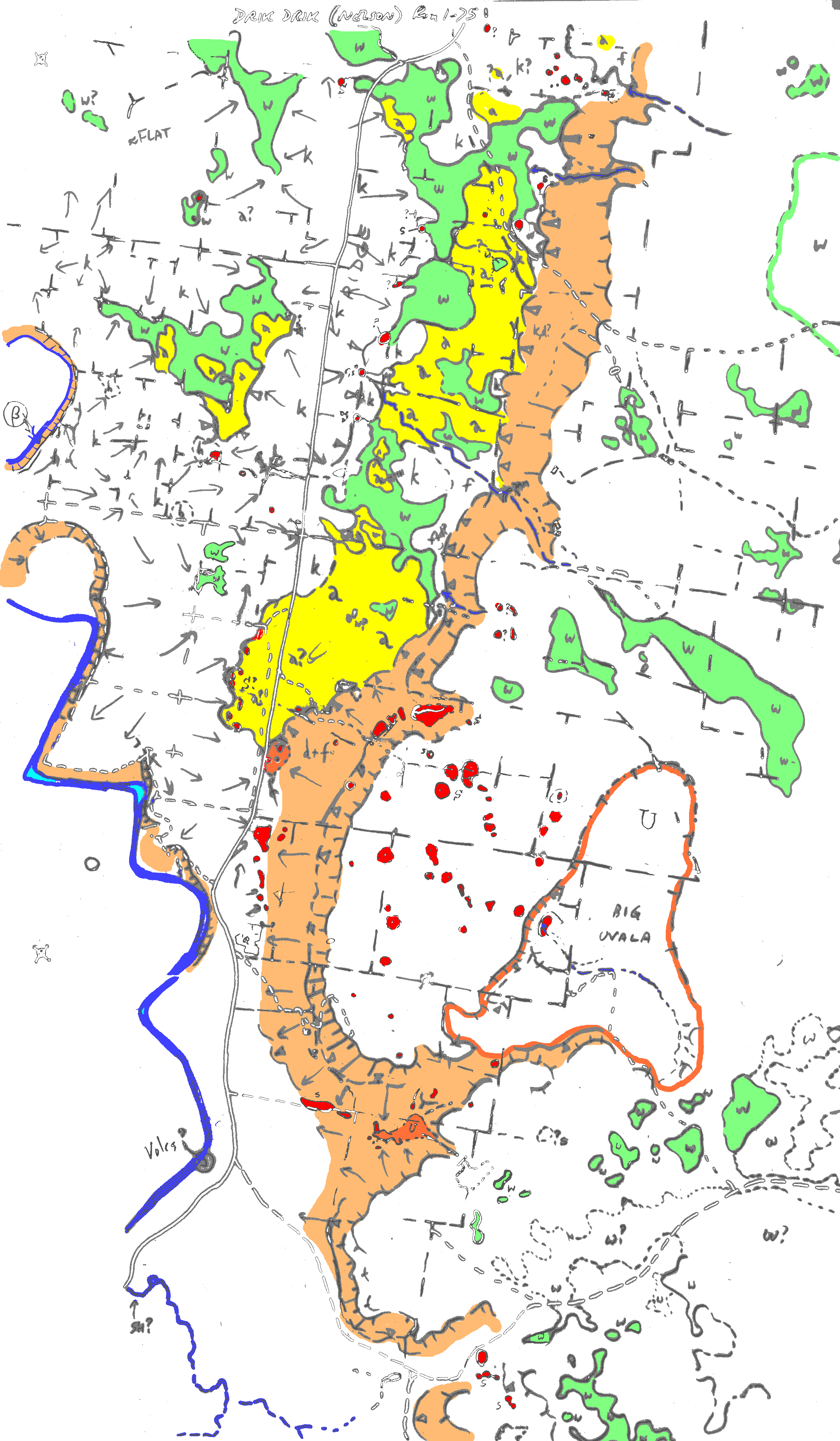
As of Feb 2004. This is an active draft and subject to change.
Red = Dolines
Orange = large uvala
Brown = scarp
Green = swampy areas (dune hollows?)
Yellow = alluvium
File: 3DD-Phot.png
This is a soft-rock karst region with a complex geological history. Karst and caves have formed in both Tertiary limestones and overlying Quaternary calcareous dunes. In addition there is a plateau capped with late Tertiary basalt that has subjacent karst dolines. The edge of this plateau may be a fault scarp.
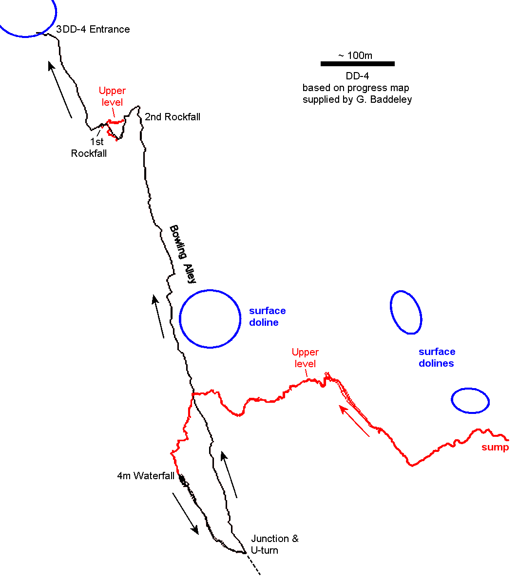
The longest known cave (3DD-4) currently has about 2 km of stream passage. This is entered at its downstream end via a large collapse doline on the scarp and the stream passage extends back beneath the plateau, whith an spiral pattern so that it circles beneath itself. The cave has numerous mud speleothems.
Exploration and karst studies by the Victorian Speleological Association is continuing. The reports included here are only preliminary.
|
|
KG.Grimes' photointerpretation map of karst and other topo features in the Drik Drik area. As of Feb 2004. This is an active draft and subject to change. Red = Dolines Orange = large uvala Brown = scarp Green = swampy areas (dune hollows?) Yellow = alluvium File: 3DD-Phot.png |
|
Draft cave map of DD-4. Circa 2004, and being actively updated as the survey progresses. Upper levels shown in red. Arrows show stream flow direction Blue = surface dolines. File: 3DD4-map.png |