Photos of Umpherstons, Little Blue Lake, and Gouldens Hole appear below.
See also the paper by Webb et al, 2010: on the possible volcanogenic origin of the cenotes.
|
|
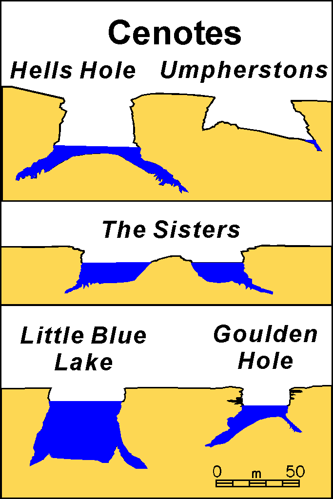
Cross sections of some typical cenotes in the Mt. Gambier region Photos of Umpherstons, Little Blue Lake, and Gouldens Hole appear below. |
|
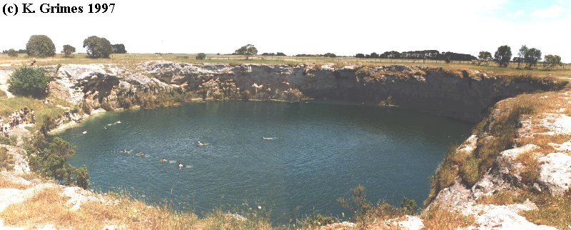
Little Blue Lake - a cenote. Panorama view, Mt Gambier, SA Blue_WA.jpg |

|
Town Hall sinkhole, after rennovations in 2003 (the vegetation has not yet recovered) With active runoff from the streets after a rain-storm. The right hand waterfall has passed through a filter which removes solid material, but not liquid pollutants. The smaller left hand waterfall is unfiltered. D042531.jpg |
|
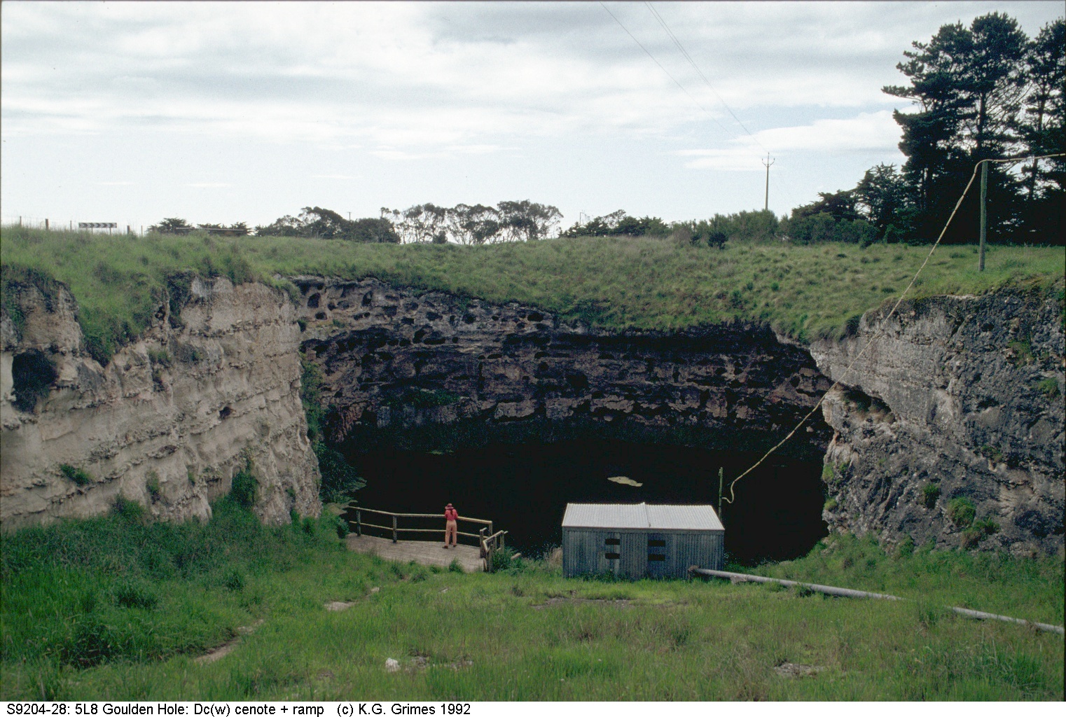
Gouldens Waterhole, Mt. Gambier. The ramp was cut by early settlers to allow their cattle to water. The platform was later added for divers. S9204_28.jpg |
|
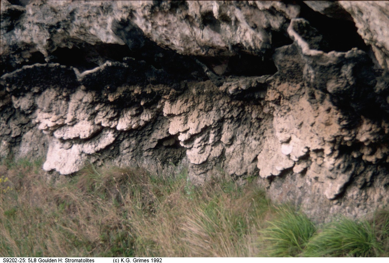
Stromatolites (calcareous algae growths) exposed on the walls of Goulden's Hole. These would have grown when the water table was higher in the past. S9202_25.jpg |
|
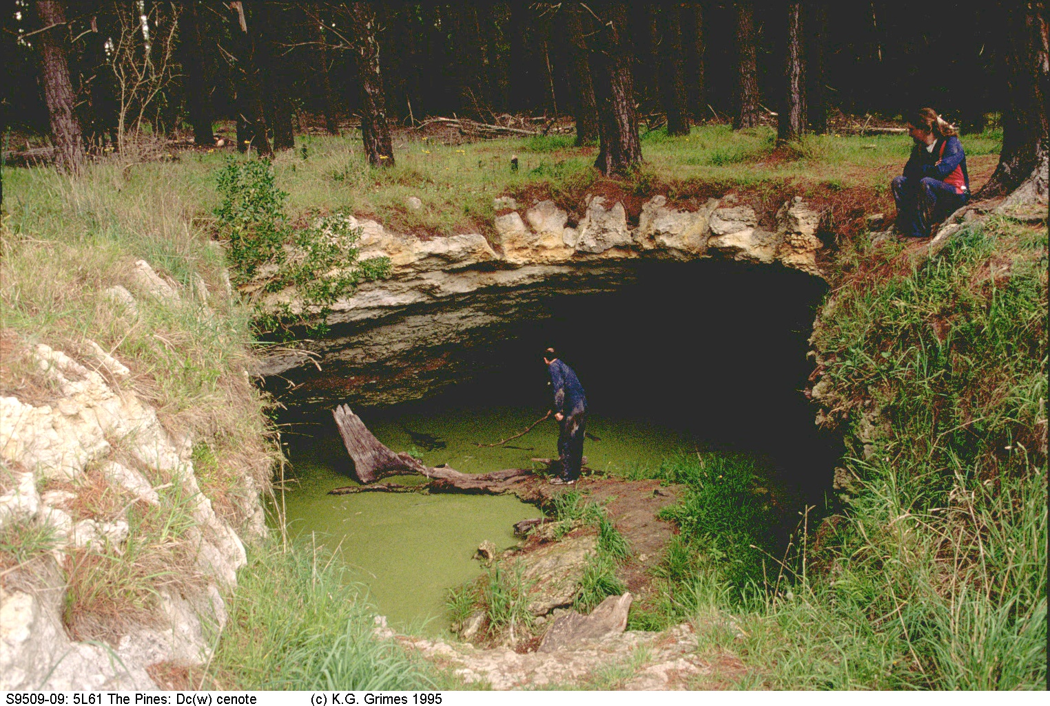
The Pines cenote, 5L-61, Mt Gambier, SA A popular site for cave divers. S9509_09.jpg |
|
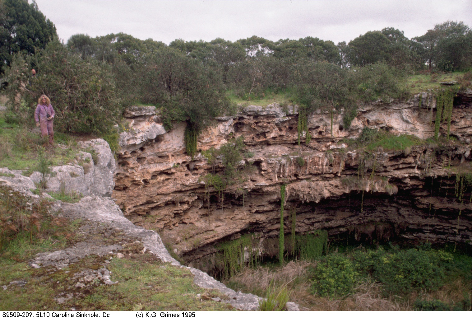
Caroline sinkhole, 5L-10, Mt Gambier area, SA S9509_20.jpg |
|
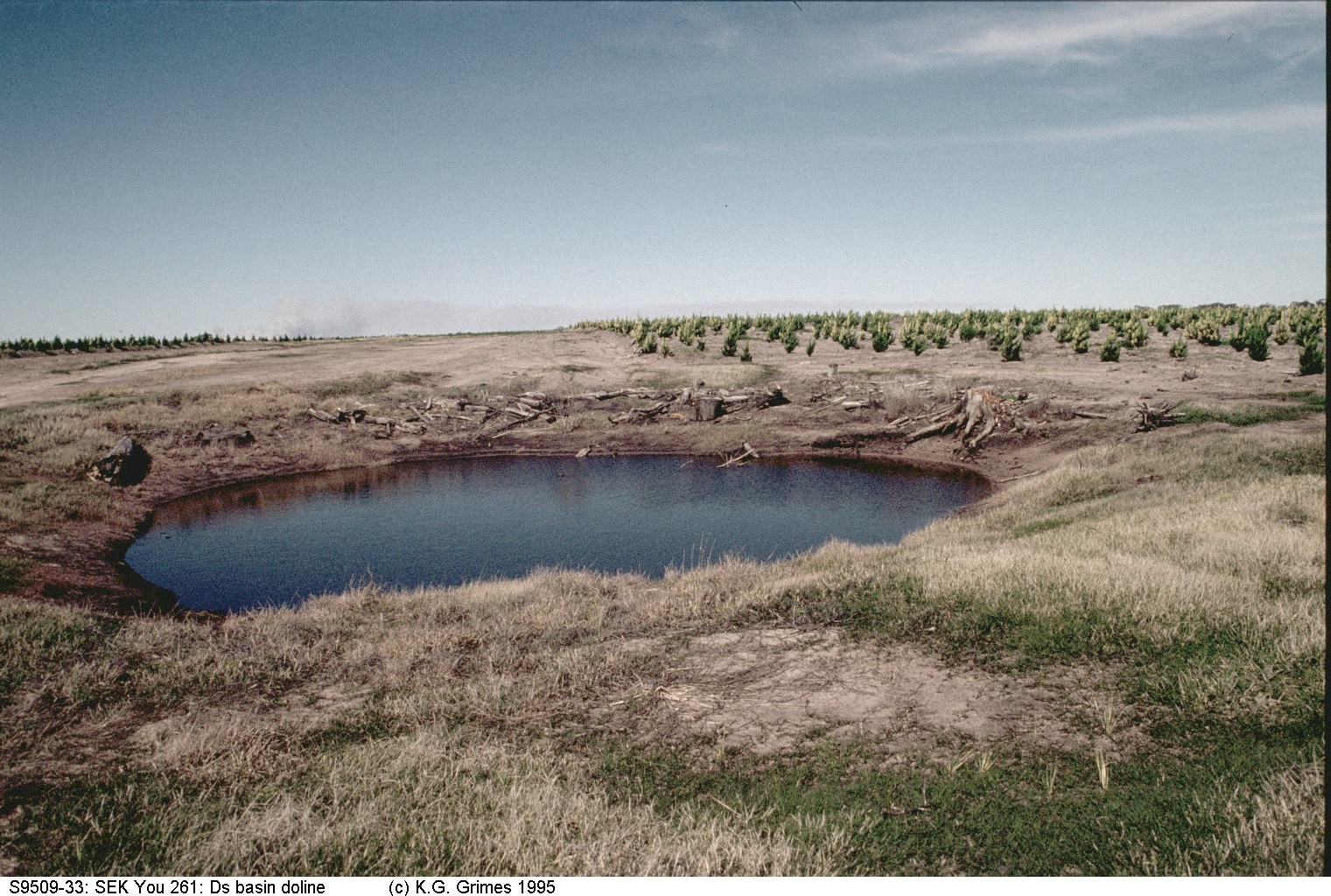
Small water-filled doline in a new plantation of exotic pines. This may be a perched watertable, not the regional watertable. S9509_33.jpg |