Grimes, KG., 1974: Mesozoic and Cainozoic geology of the Lawn Hill, Westmoreland, Mornington and Cape Van Diemen 1:250 000 sheet areas, Queensland. Bureau of Mineral Resources, Geology & Geophysics, Australia, Record 1974/106 (unpublished).
McFarlane, M.J., Ringrose, S., Giusti, L. & Shaw, P.A.,1995: The origin and age of karstic depressions in the Darwin - Koolpinyah area of the Northern Territory of Australia. in Brown, A.G. (editor) Geomorphology and Groundwater, Wiley, pp.93-120.
McFarlane, M.J. & Twidale, C.R., 1987: Karstic features associated with tropical weathering profiles. Zeitschrift fur Geomorphology(NF), Suppl-Bd. 64: 73-95.
Selected photographs and diagrams
To view full size images, click on the displayed image.Solution Dolines, or "Pans"
|
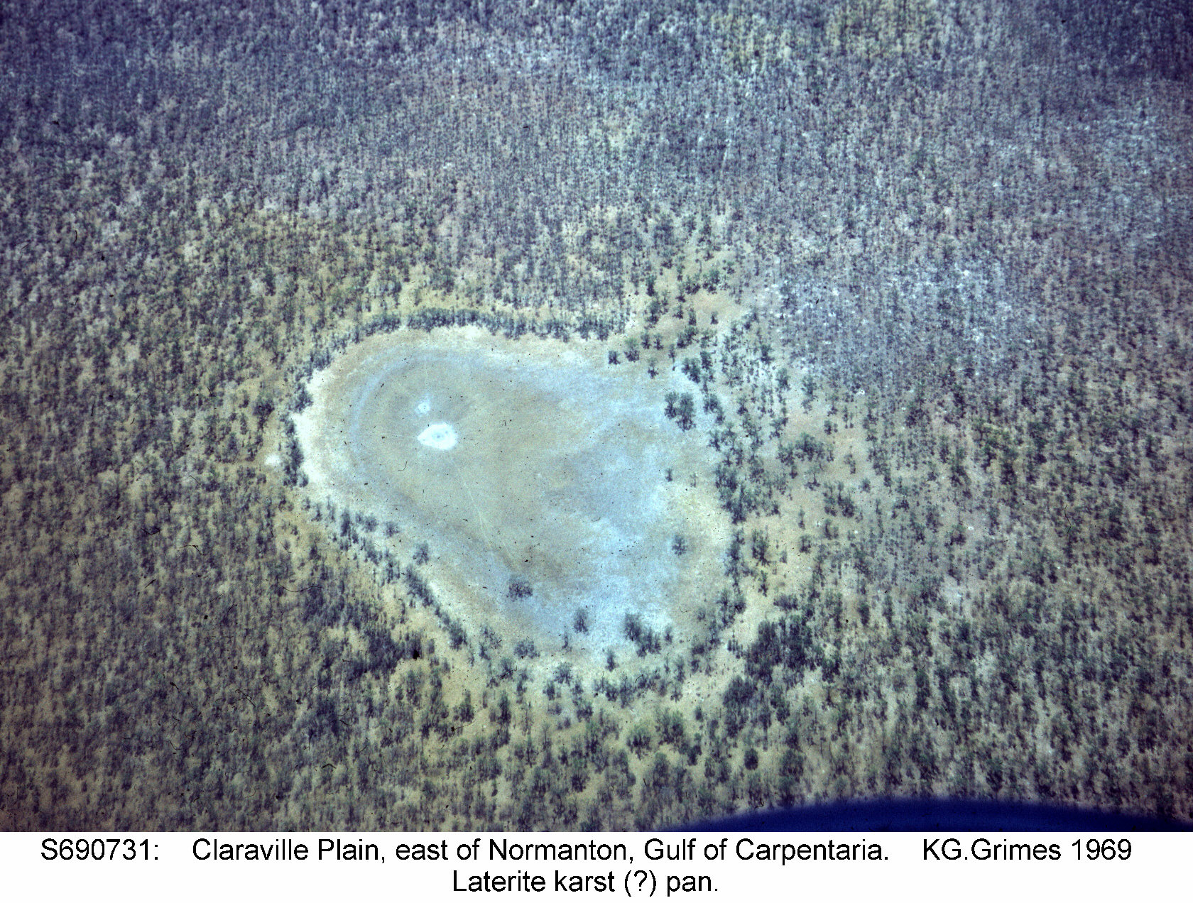
Aerial oblique view of a shallow pan on a lateritic plain in the Gulf of Carpentaria, Queensland.
S690731.jpg |
|
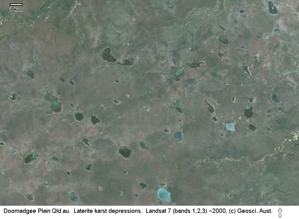
Landsat image of unusually angular pans on the lateritic Doomadgee Plain, Gulf of Carpentaria, Queensland. See Extract from Grimes (1974). Click the image to see a detailed view There is now high-resolution Ikonos imagery of part of this area available via Google Earth (Lat 17°32'S, Long 139°05'E) Doomadgee-123.jpg |
|
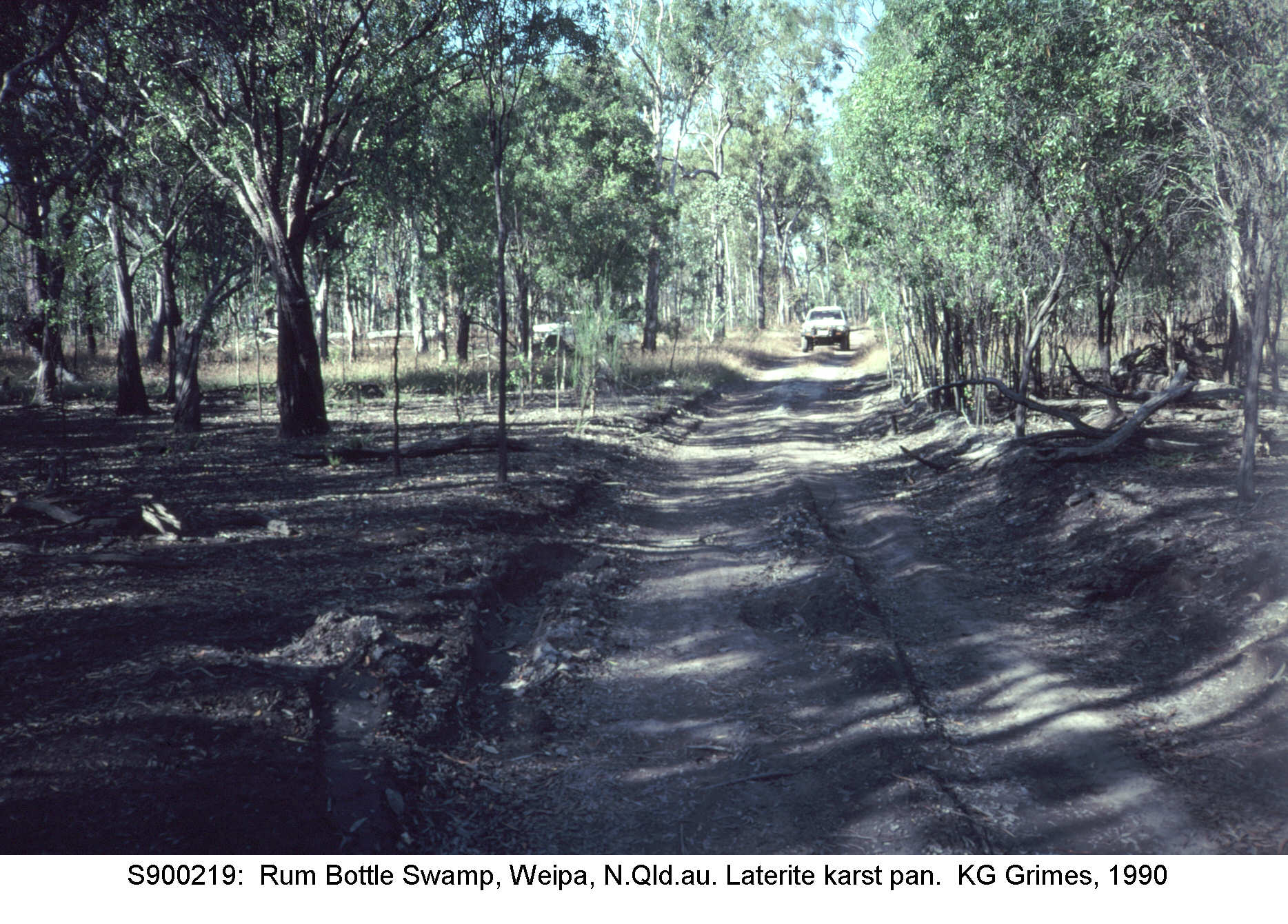
Grey swampy soil on the floor of a laterite pan. Weipa, N. Qld.
S900219.jpg |
|
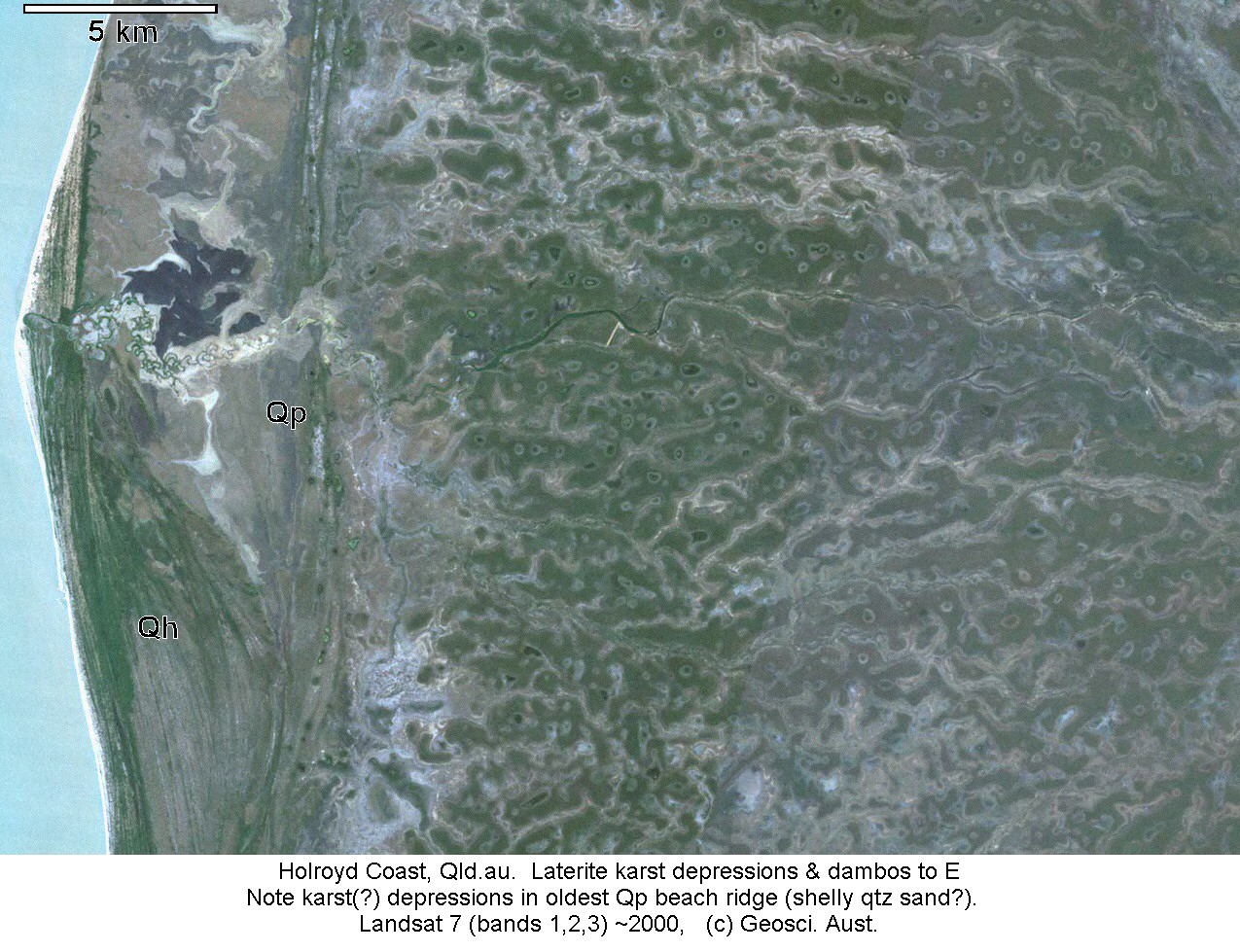
Landsat image of the west coast of Cape York Peninsula, Queensland. On the eastern side, dambos and pans occur on a low-lying lateritic surface. Along the coast are Quaternary beachridges (Qp & Qh). The inner, last interglacial (Qp), ridges also have pans, but in that case the formation is probably solution of shelly material in the beach sands, rather than silicate karst. Click the image to see a detailed view There is now high-resolution Ikonos imagery of part of this area available via Google Earth (Lat 14°36'S, Long 141°40'E) Holroyd2-123.jpg |
|
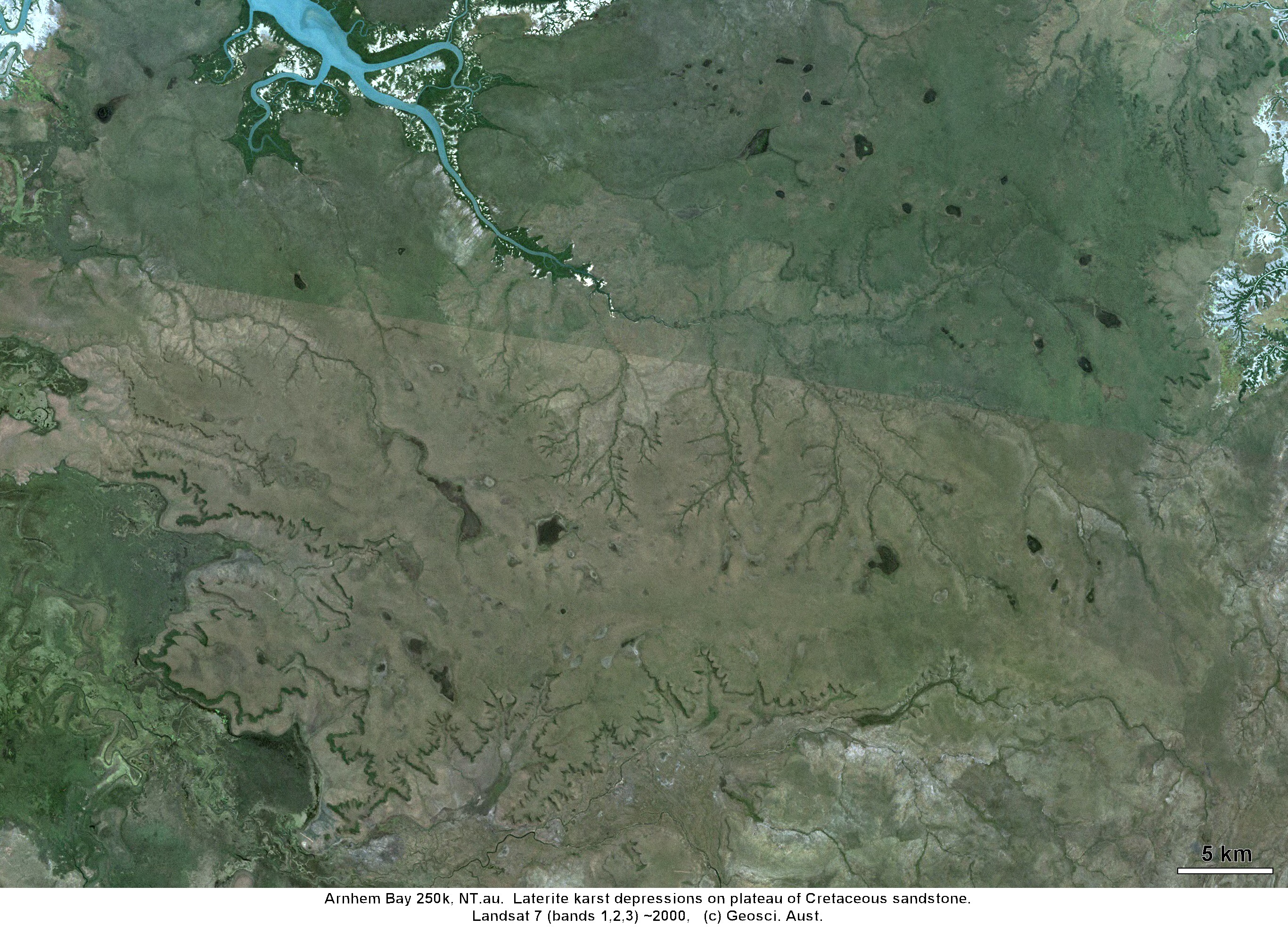
Landsat image of pans on the undissected parts of a low-lying laterite plateau overlying Cretaceous sandstone. Arnhem Bay region, Northern Territory. Click the image to see a detailed view There is now high-resolution Ikonos imagery of part of this area available via Google Earth (Lat 12°34'S, Long 135°20'E) ArnhemBay-123.jpg |
Collapse Dolines
|
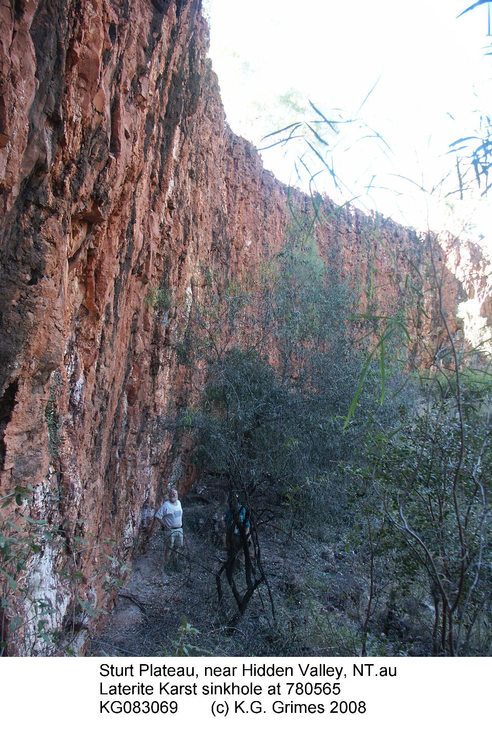
Inside a large collapse doline in lateritised Cretaceous mudstone, Sturt Plateau, near the Buchanan Highway, NT. See McFarlane & Twidale (1987) KG083069s.JPG |
Giant grikes and Stone Cities
|
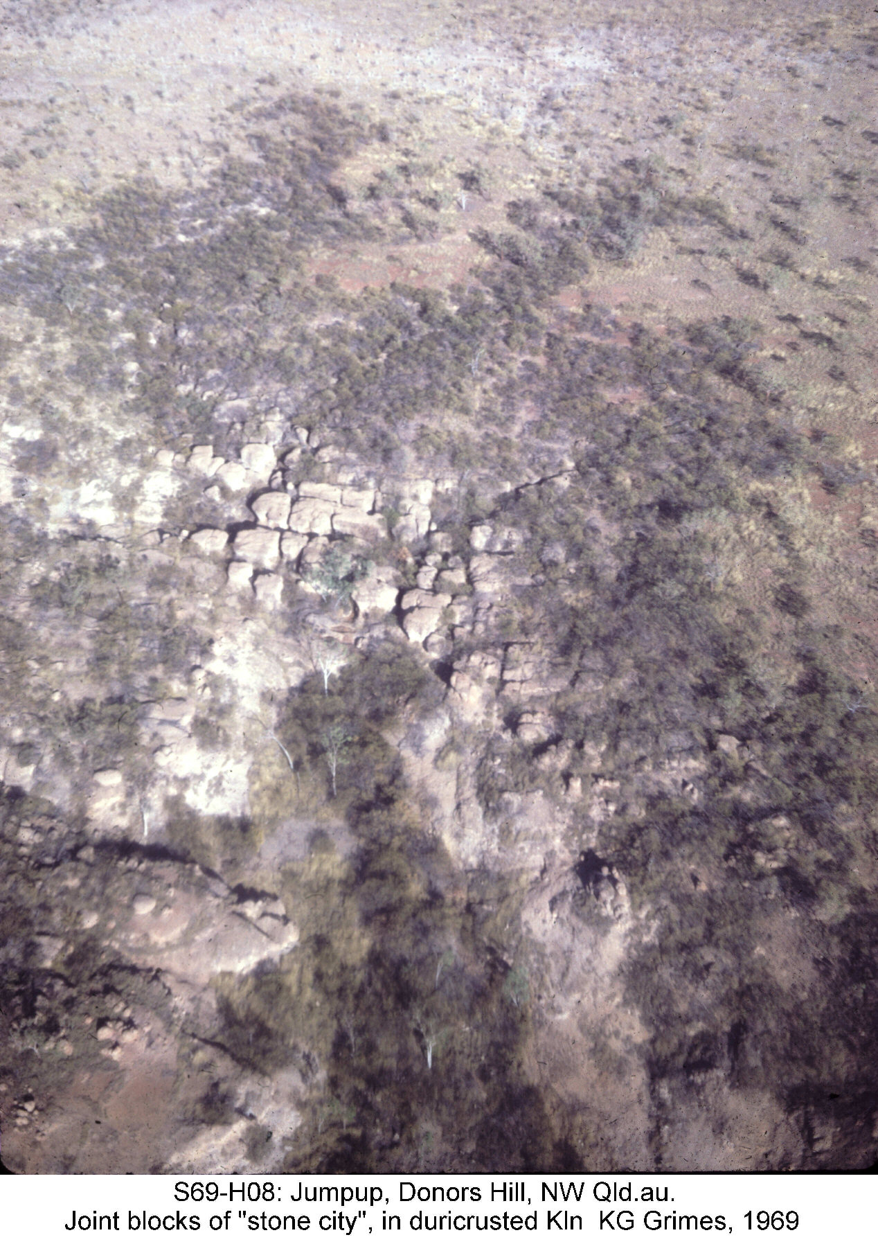
Joint blocks in duricrust on the edge of a plateau form a small "stone city" Donors Plateau, NW Qld. S69-H08.jpg |
|
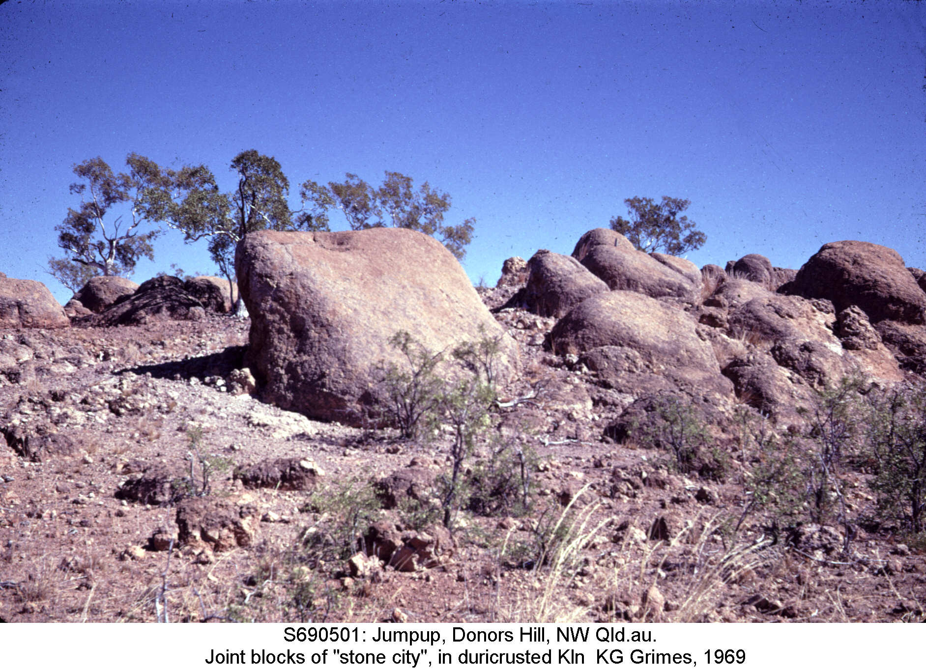
Ground view of the duricrust joint blocks. Donors Plateau, NW Qld. S690501.jpg |
Go to Main Index menu