Parakarst
Parakarst refers to karst landforms produced by solution of non-carbonate rocks. As distinct from pseudokarst which is karst landforms produced by processes other than solution.
Parakarst includes gypsum karst and salt (halite) karst, but neither of those types occurs in Australia.
Silicate karst (or parakarst) is, however, quite common, especially (but not only) in tropical Australia. Silicate parakarsts occur mainly in sandstones and granites (see Martini, 2000, 2004, and Wray, 1997)) but are also common in laterites (Grimes & Spate, 2008)
Silicate parakarst forms sandstone caves (e.g. Whalemouth Cave, WA (Jennings, 1983)) and surface landforms that can be karst-like (dolines and karren) or ruiniform (stone cities and pinnacles) in tropical areas (Jennings, 1979; Grimes et al, 2009a, Grimes et al, 2009b, Grimes et al, 2011), but it also can occur in laterite duricrusts and other silicate rocks in a variety of climates. Extensive boulder maze caves in jointed granite are transitional between this category and piping caves (e.g. Black Mountain, near Cooktown, Qld, and Labertouche Cave, Vic.).
Sandstone terrains in tropical Australia commonly have ruiniform relief (Mainguet,1972; Young et al, 2009, pp.172-180): which can be defined as sharply dissected, structurally controlled, landscapes of the giant grikefield, stone city and stone forest type, which are characterised by numerous vertical-faced blocks and pinnacles of rock separated by joint-controlled fissures or wider eroded areas (Grimes et al, 2009b). These ruiniform areas have visual similarities to karst towers, pinnacles and giant grikes. Some of these areas also have caves that appear to be at least partly solutional in origin. Examples also occur in temporate Australia. However many are borderline cases in which the main processes are other forms of chemical and physical weathering and erosion.
It is not always easy to determine if a particular sandstone (or other, non-limestone) cave is true silicate karst, or whether it has formed by a combination of several process, e.g. solution, other chemical weathering processes (e.g. hydration), and piping and other forms of mechanical erosion of the soft weathering products. For example, tafoni are included in silicate karst by some people, but the processes probably involve more than straight solution.
Arenisation
Arenisation is a process of interacting chemical and physical processes that can lead to development of ruiniform and karst-like features in quartzose rocks. It entails slow chemical dissolution along crystal boundaries to free grains and leave the rock less competent and more susceptible to physical erosion (see diagram, Martini, 2004). Sand grains can then be easily removed by flowing water and piping. The weathering process is commonly concentrated along joints, and the preferential erosion of the arenisedgrains from those zones produces ruiniform terrain.
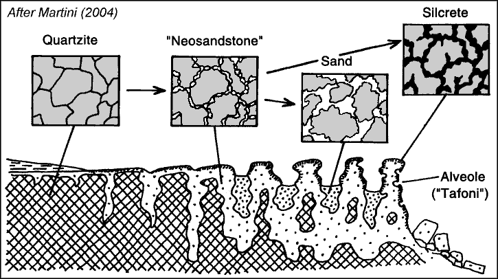 Arenisation: The process of loosening of
sandstone grains to produce a readily-eroded material. Note the selective weathering along joints to form grikes and pinnacles.
Arenisation: The process of loosening of
sandstone grains to produce a readily-eroded material. Note the selective weathering along joints to form grikes and pinnacles.
Some Australian examples:
Further Reading
Grimes, KG., Wray, R.A.L., Spate, A.P., & Houshold, I., 2009a: Karst and Pseudokarst in Northern Australia. A report to the Department of the Environment, Water, Heritage and the Arts, by Optimal Karst Management.
Grimes, KG., Wray, R.A.L., Spate, A.P., & Houshold, I., 2009b: Illustrated Glossary of Terms for Ruiniform and Karst-like features
in Silicate Rocks. A report to the Department of the Environment, Water, Heritage and the Arts, by Regolith Mapping.
Grimes, KG., Wray, R.A.L., Spate, A.P., & Houshold, I., 2011: Karst-like & Ruiniform Sandstone Features. Poster presented at the 2011 ASF conference, Chillagoe.
Jennings, JN., 1979: Arnhem Land city that never was. Geogr. Mag., 60: 822-827.
Jennings, JN., 1983: Sandstone pseudokarst or karst? in RW Young & GC Nanson (eds), Aspects of Australian Sandstone Landscapes. Australian and New Zealand Geomorphology Group, Special Publication, 1: 21-30.
Mainguet, M., 1972: Le Modelé des Grčs. Insitute Géogaphique Nationale, Paris.
Martini, J.E.J., 2000: Dissolution of quartz and silicate minerals. in Klimchouk, A.B., Ford, D.C., Palmer, A.C., and Dreybrodt, W., [eds], Speleogenesis - Evolution of Karst Aquifers, National Speleological Society, Huntsville. p. 171-174.
Martini, J.E.J., 2004: Silicate Karst, in Gunn, J., [ed.] Encyclopedia of Caves and Karst Science. New York: Fitzroy Dearborn. p. 649-653.
McFarlane, M.J., Ringrose, S., Giusti, L. & Shaw, P.A.,1995: The origin and age of karstic depressions in the Darwin - Koolpinyah area of the Northern Territory of Australia. in Brown, A.G. (editor) Geomorphology and Groundwater, Wiley, pp.93-120.
McFarlane, M.J. & Twidale, C.R., 1987: Karstic features associated with tropical weathering profiles. Zeitschrift fur Geomorphology(NF), Suppl-Bd. 64: 73-95.
Wray, RAL., 1997: A global review of solutional weathering forms on quartz sandstones. Earth Science reviews, 42: 137-160.
Young, R., & Young, A., 1992: Sandstone Landforms. Springer-Verlag, Berlin etc. See chapter 4 "Chemical weathering and cavernous weathering".
Young, R.W., Wray, R.A.L., Young, A.R.M., 2009: Sandstone Landforms. Cambridge University Press, Cambridge. 304 pp.
Translated papers
Partial translations of several papers on silicate and laterite parakarst have been done by Janeen Samuel.
Selected photographs and diagrams
To view full size images, click on the displayed image.
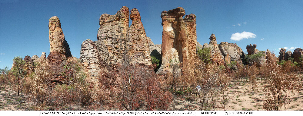
Sandstone stone cities
|
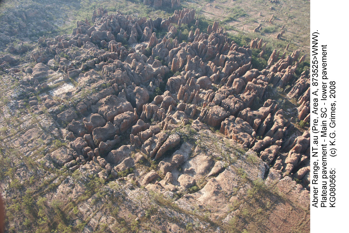
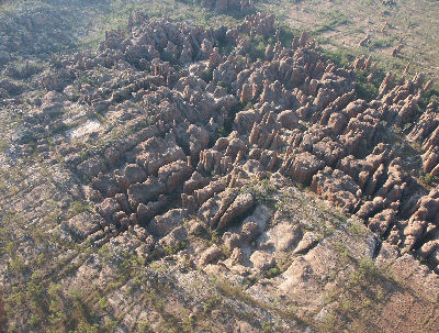
Across much of tropical Australia, strongly jointed sandstones form fissured plateau (ruiniform relief) that may break up into "stone cities". This aerial image shows the gradation from a plateau pavement (with small grikes) at the lower left, through a giant grikefield and stone city to scattered pinnacles on a lower-level modern pavement (pediment) at top right. The width of the dissected belt is about 400m.
Abner Range (Cape Crawford "Lost City"), NT.
KG080565a.JPG
|
|
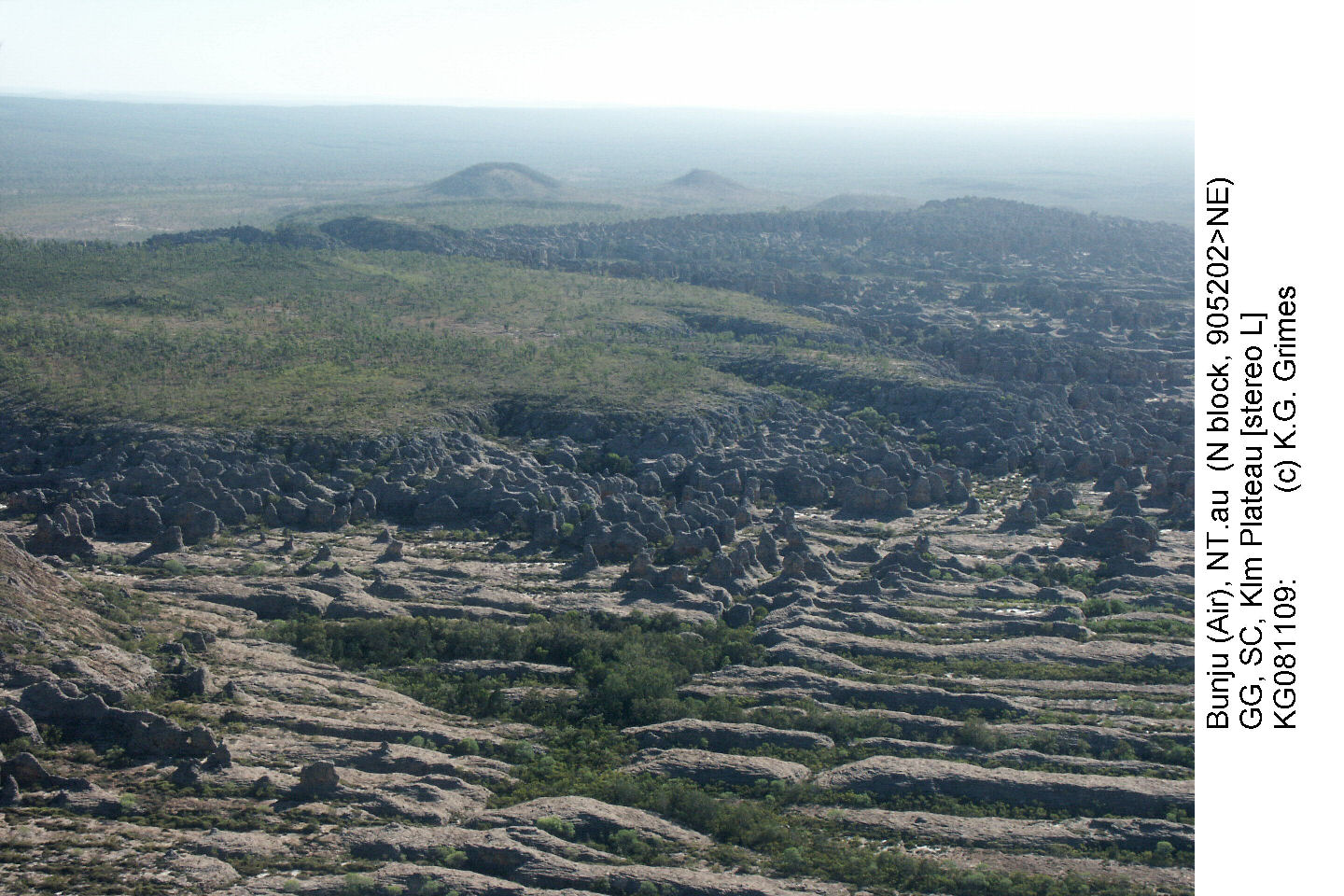
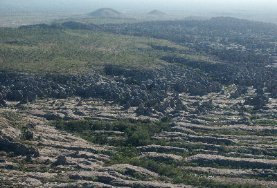
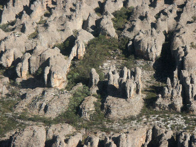
Aerial view of Bunju (previously reported as "Boorlungu" by Jennings,1979), where different layers of the gently dipping Proterozoic sandstone form different styles of parakarst.
In the foreground is a field of giant grikes, which are overlain by a bed forming pinnacles and stone city. The plateau top is a younger Cretaceous sandstone.
Bunju (pronounced "Boon-joo"), Arnhem Land, NT.
KG081109.JPG.
|
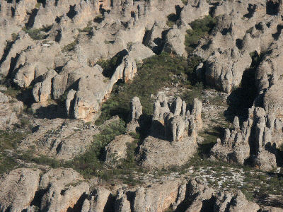 |
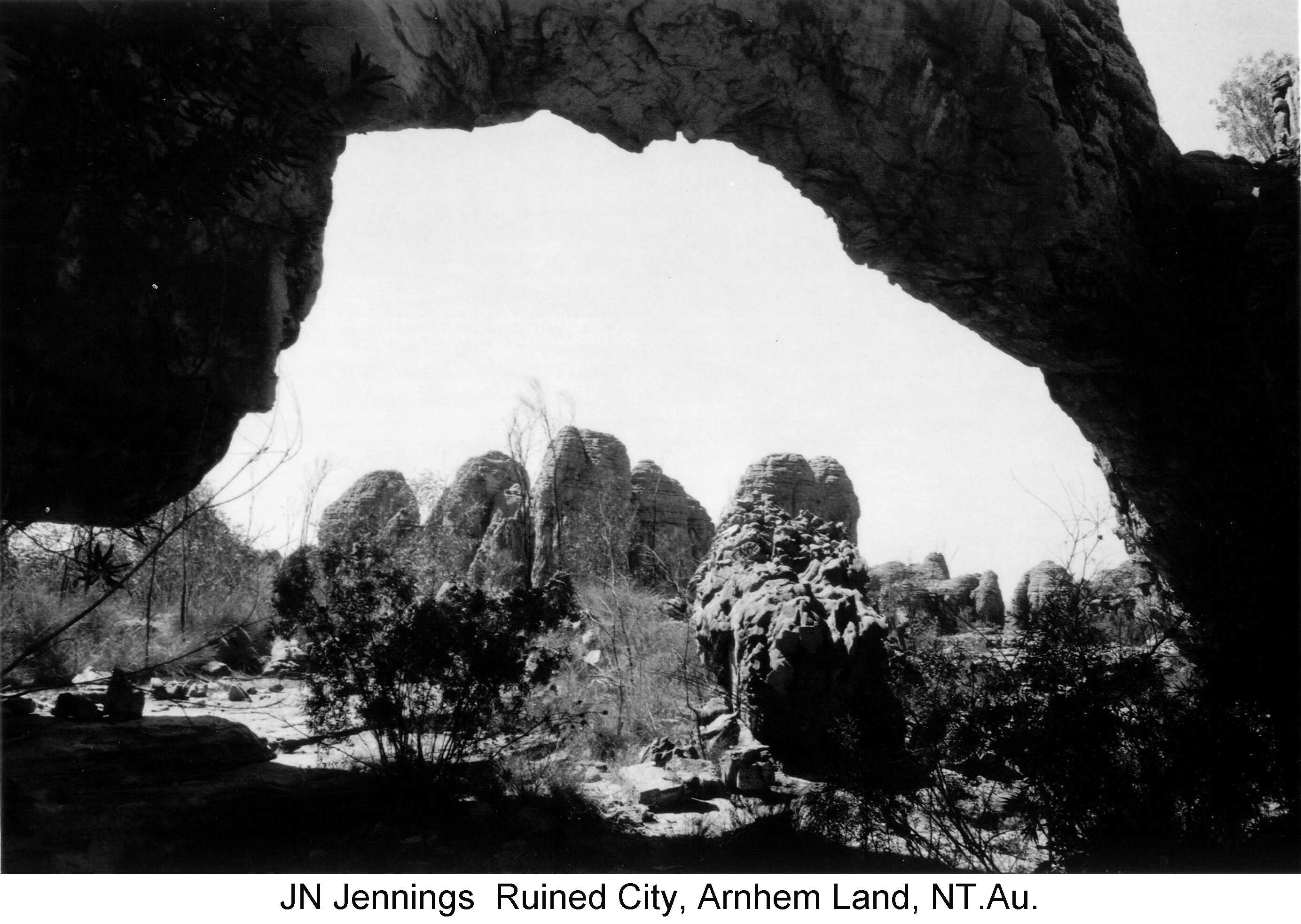
|
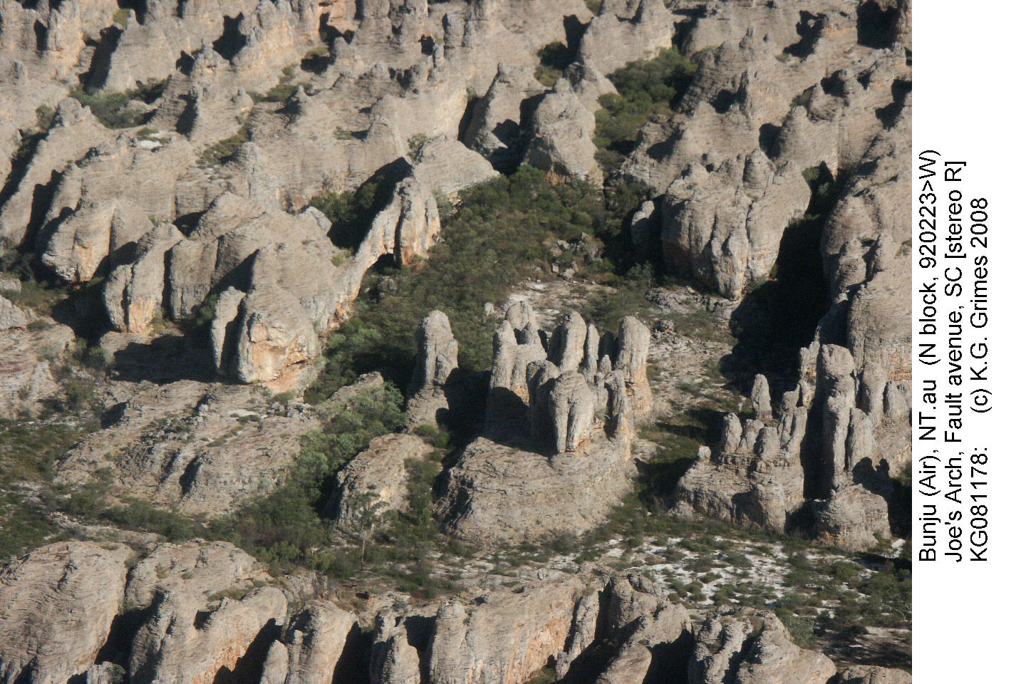
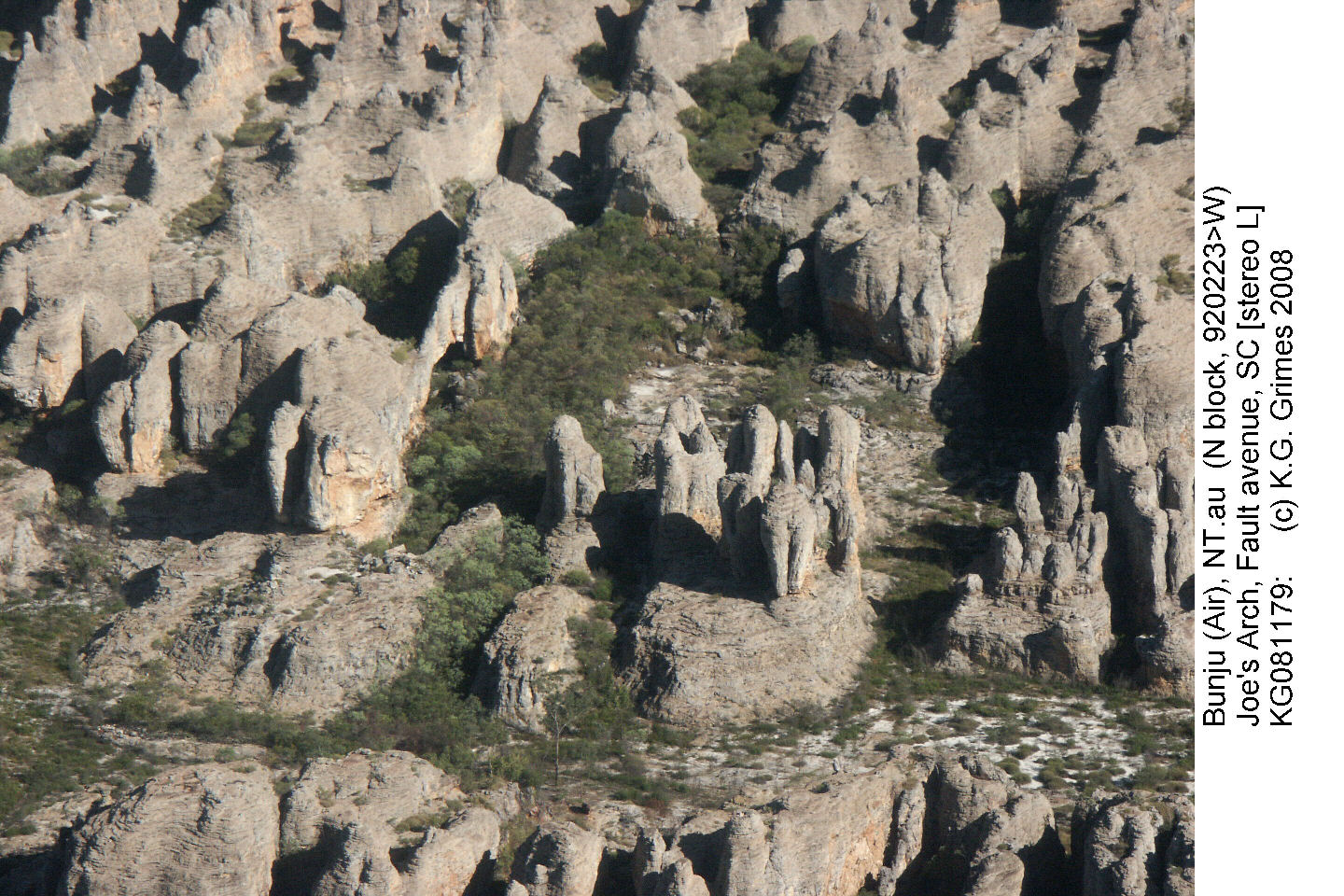
Aerial view of a "stone city". A large "avenue" in foreground has smaller "streets" running off it. The "plaza" in the middle of the photo has a large arch on the left side (see photo below, by Joe Jennings).
Bunju, Arnhem Land, NT.
Stereopair - view cross-eyed
KG081178.JPG & KG081179.JPG
|
|
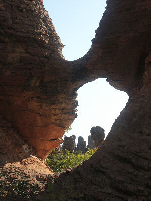
Ground view of an arch and pinnacles at Bunju, Arnhem Land, NT.
See Jennings (1979)
Photo by Joe Jennings - JJ-RuinedCity07.jpg
|
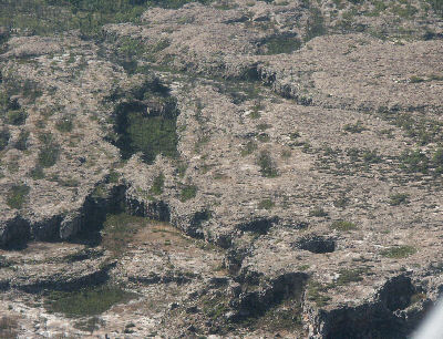
|
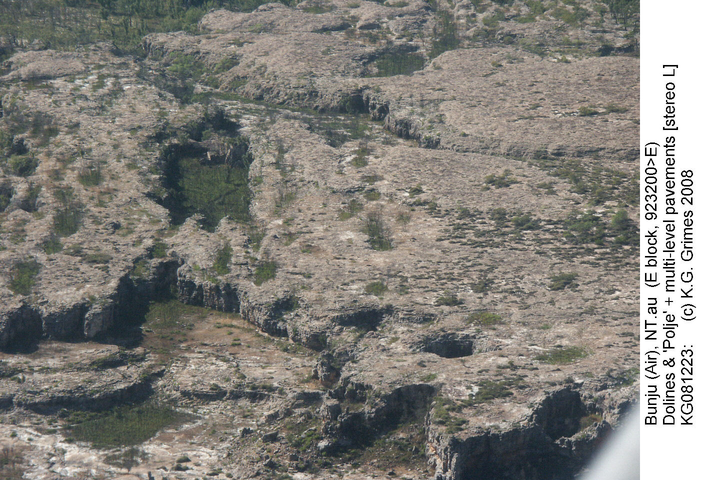
A doline field on a sandstone plateau. The forground scarp has cave entrances which may connect to the deep circular dolines behind it (to right). Other deep and shallow (vegetated) depressions can be seen, including a large flat-floored one in the middle of the photo.
Bunju, Arnhem Land, NT.
KG081223.JPG
|
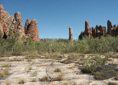
|
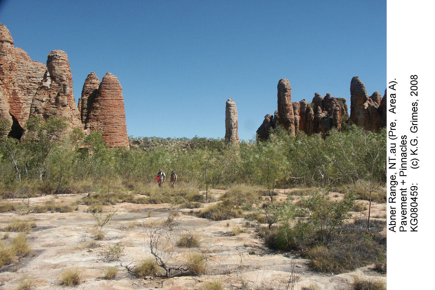
Ground view of pinnacles at the edge of a stone city, with a modern pavement (pediment) in the foreground.
Abner Range (Cape Crawford "lost city"), NT.
KG080459.JPG
|
 |
|
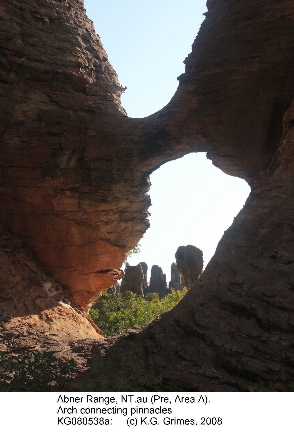
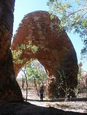
Two small arches:
Left = Abner Range (Cape Crawford), NT.
Right = "Western Lost City" at Limmen NP, NT.
KG080538a.JPG & KG080837P.JPG
|
Go to Main Index menu